Santa Cruz North Coast

One Year After Our Big Fire

Since the firestorm of 2020, I’ve witnessed both the rebounding resilience of nature as well as post-fire human responses that have ranged from truly awe-inspiring to bewildering. When the fire first struck, I had a harrowing 10-day amateur-firefighting experience. I well recall the panic – and the portentous moment when toasted tanoak leaves floated down from the smoke-darkened sky. Soon thereafter, the march of head-high flames incinerated everything on our farm that we couldn’t save with just us two people and our heavy fire hoses. After the smoke and flames – and through the entire year since – there’s been so much change.

This story starts last August, when we endured three days of wilting heat. Then, a hurricane hundreds of miles south of us went rogue, splitting in two, half of it raking quickly across the length of California. I woke to that half a hurricane – a massive silver-gray cloud-wall steaming and rolling north along the coast and a 10-minute-long 70-mph wind gust accompanying devilish sheets of whole sky-enveloping lightning and unbroken thunder. Soon, lightning-ignited small fires in too-remote areas joined together into a monstrously huge and fast-moving firestorm. State firefighters could not gather resources quickly enough to fight it and called for evacuations, and all but one person escaped with their lives. Non-humans fared less well. The smoke and flames took a month to dissipate, allowing thousands of evacuees to return to what, if anything, might be left of their homes.

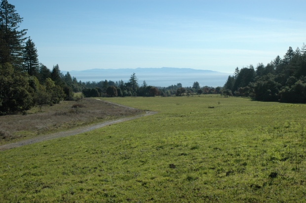
The fire left a landscape of blowing ash and a hundred shades of charcoal gray with sporadic patches of toasted brown vegetation and very few areas of green plants that somehow escaped the flames.

Before the fire, lush redwood forests had dripped fog onto carpets of ferns and sorrel. Under high conifer canopy, Pacific wrens whistled away the days in brilliant, wandering sunrays. Daylight transitioned into forest-hushed nights with owls hooting and woodrats rattling their fleshy tails. Those same forests, after the fire, were spires of high, blackened, tree-trunk pillars with few branches remaining. These towered over ankle-deep, white, fluffy ash and patches of crunchy charcoal. All the animals were gone … many had roasted alive.

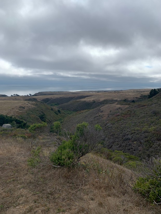
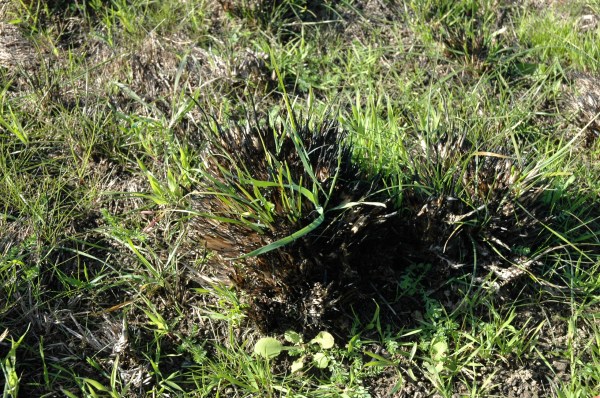
Before the fire, the ridgelines above those forests had been dense chaparral. There were millions of 10-foot-tall, lush, green pines erupting through rafts of shorter shrubs – a dazzling array of colors with resinous and sweet scents and a multitude of textures. Eleven years previous, the Lockheed Fire had burned much of this chaparral, and all this life had since rebounded. In the wake of that fire – a timebomb: criss-crossed, 6–12-inch-diameter logs from killed and gradually falling pines piled up hip-high for thousands of acres and miles around. During last year’s firestorm, those logs burned so hot they left impressions criss-crossing the hillsides, each outlined in white ash and vaporizing what little soil there was into red brick. That heat cleared ridge after ridge down to the stone we call “chalk rock,” a fractured mudstone crushing easily or making metallic, pottery-shard noises when you walk across it. For months after the fire, peering closely, nestled in piles of charred rock, you could find little fingers of burned stems and twisted fists of stump-like burls, all black, seemingly lifeless.

Among these forests and in the chaparral, people were living in neighborhoods and rural properties large and small. Since the early 1900s, neighborhoods had gradually developed, woven in between natural areas and parks set aside for redwood conservation and recreation. The fire destroyed the remote Last Chance neighborhood and badly affected other neighborhoods in the hills above Boulder Creek. The fire also tore through the Swanton community and then much of Bonny Doon. These communities contained layers of history. Generations-old families shared this landscape with the newest wave of neighbors from the wealth machine of Silicon Valley. University of California administrators and professors, along with student renters, were living alongside old hippies and back-to-the-landers of all political persuasions. There were also many blue-collar tradespeople, teachers, and retailers. This was a mixing pot of politics, perhaps with more left-leaners, and all united by a love of rural living. They found ways to be good neighbors from sharing news to clearing roads and helping newcomers figure out how to settle in comfortably with the various issues unique to this part of the Santa Cruz Mountains.

The fire burned homes new and old, whether they were owned by the super-rich or the very poor. There were dilapidated, barely habitable shacks surrounded by old cars, tattered furniture, and storage sheds with recyclables overflowing into the surrounding forest. And then there were the fancier estates – polished redwood decks, outdoor kitchens with marble countertops and brick pizza ovens, fancy hot tubs, and English gardens with statuary. These varied developments were all mixed up in the matrix of shrubs and trees, chaparral, and forest – one of the two most diverse natural landscapes of North America. The fire made the patches of human stuff into the same types of ash and waste: deep piles of charcoal and blowing nasty ash accented in places by unrecognizable twisted metal and piles of collapsed brick. New cars or old – it was hard to tell from the burned-out, fire-wasted frames. It was impossible to tell where the landscaping stopped, and the wild places began.

People’s responses to the fire were even more varied than their ways of life had been prior to the fire. During the peak of the fire and for the long period of smoldering and even longer evacuation period, the few brave and stalwart worked hard protecting their homes, their neighbors’ homes, their pets, and human friends wherever possible. On the edges of retreating flames, packs of looters swept in, stealing from houses burned and those that were spared. A standoff between the stalwart stay-behinds and looters resulted in a looter getting shot in the leg. Someone who lost nearly everything set aside some mementos at dusk, only to find them gone the next morning. A year later, strangers still lurk around the burned areas looking for stuff to steal. As if the fire itself weren’t enough.

The many who lost their homes were scattered. A few quite visible ones took up trailer homes along the highway in Davenport. Many moved to rentals or into homes with friends, adding to the crowded town. After a few, seemingly long months of waiting, the government-run cleanup started: giant machines scooping and scraping the charred piles of debris into convoys of trucks, hauling the stuff “away.” We were impatient and then happy for the efficiency, strength, and scale of this enterprise. No one asked and there was no news about where that stuff went, what the communities and land think of how we disposed of it, far away from here. After cleanup, some people sold out while others stayed put. It was a sellers’ market, but that meant those selling out faced grim realities for purchasing anything else in the area, and some were forced to leave. Slowly house trailers appeared on wrecked properties. A small fraction found the means to start rebuilding.

Between the remaining homes or the burned-up human stuff, some people (like me) were fascinated and relieved by the resilience of nature, bolstered by its ability to heal and rebound. To others, nature was too slow—they wanted a kind of speed healing and found many ways to apply Band-Aids to cover the fire’s wounds. Some know nature heals but wanted to help it along. Others had no sense of nature and acted like alien gardeners on some other planet. Others were never much at tending the land: they had never been much interested in such things. County-hired contractors hydroseeded burned building sites and surrounded them with straw bundles to contain toxic runoff. RCD employees were heroes, working ceaselessly to help stunned property owners prepare for post-fire rains, erosion, and slope failure. Meanwhile, people were tossing around native wildflower seed mixes to hopefully brighten land. Others, wanting more instant and positively perky landscapes, dug in thousands of roadside daffodil bulbs to persist and spread for centuries, a long-lasting and sad legacy spurred on by a well-meaning community leader.

Along roadsides and powerlines, orange-vested, hard-hatted officials spray-painted numbers on thousands of dead or damaged trees, and then the saws and grinders got going. Months of chainsaws and chippers whined and roared, shaking the earth and sky, filling hundreds and hundreds of trucks, hauling more stuff to yet unknown fates and destinations: “away.” People already traumatized by burn damage faced another shock as workers removed patches of forest in what was left of their yards, forever changing their historic views, removing their remaining privacy … all in the name of road or utility safety … or perhaps liability.

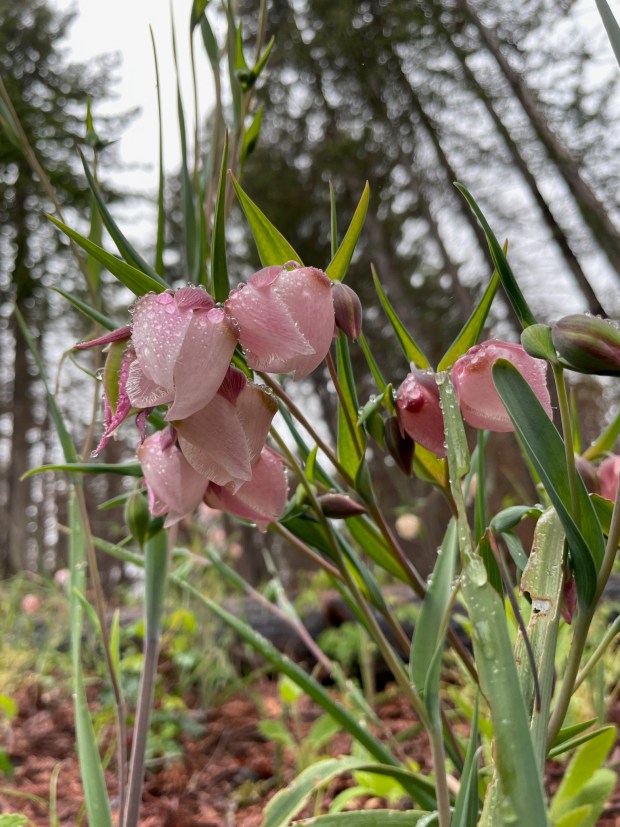
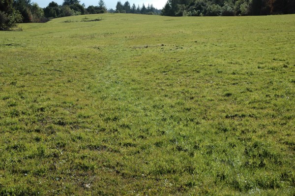
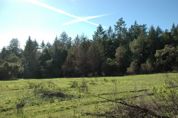
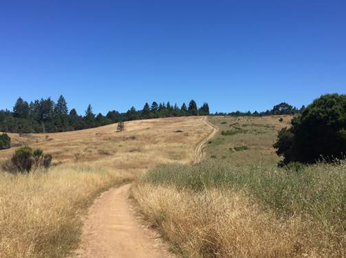
The first spring after the fire, the forest surged with life. Most redwood and oak trees that had burned resprouted. Some sprouted from their charred trunks, while others sprouted only from their bases. Understory herbs filled the spaces between the trees – twining vines, prickly thistles, and carpets of wildflowers. In many places, the forest floor was brighter than we had ever witnessed – dazzling flowers! Splashes of cream or blue iris bloomed profusely alongside extensive rafts of pale pink globe lilies. Animal life returned, too. Hungry deer shortened tanoak sprouts by the mouthful. Fish biologist “snorkel surveys” spotted surprising numbers of steelhead in the burnt and newly sun-brightened streams. Shortly after the fire, great horned owls hooted from recently cooled trees. A few more healing months and then pygmy owls also were cheerfully hooting away from the scorched forest.

The chaparral mostly rebounded, too. First there were many bush poppy sprouts…and many, tiny seedlings. Then, very slowly, the many fewer manzanita burls began pushing up sprouts. Chaparral oaks, madrones, and chinquapin joined the resprouting. In late April, the diverse fire-following flowers were starting their famous post-fire show. Massive patches of whispering bells carpeted hillsides – ferny foliage and pale-yellow bell-shaped flowers along with an odd scent that some people enjoy. An intrepid bunch of botanists I hiked with discovered a new population of small-flowered blazing star. And, we found previously undocumented areas of pink-purple stinging lupine, as well as sweetest-scented, tiny phacelia with yellow and pink flower mounds, and one new patch of the sapphire blue–flowered twining snapdragon. By midsummer, I could still walk easily through extensive areas of chaparral in the bare spots between resprouted 2-foot-tall shrubs and trees. Big patches of bright yellow bush poppies were feeding innumerable bees.

I could find only a very few pine and manzanita seedlings, so the chaparral will look a little different in the wake of this fire compared with the last fire. The cooler burning Lockheed Fire created massive thickets of knobcone pine seedlings – extending for miles outside of the fire footprint, where seeds were blown on the fire wind. With the very dry winter following this more recent fire, along with fewer pine cones and a short-lived seedbank, many fewer knobcone pines may regenerate this time around. With the aforementioned piles of Lockheed Fire–killed knobcone logs, the ground temperature got so hot that many ancient manzanita burls were destroyed. So, now fewer manzanitas and perhaps more open space (more weeds, more grasses or wildflowers?) will characterize the next generation of this chaparral.

Wildlife has recovered in the chaparral areas. The deer were most evident – I found bedding areas nestled into the protective, denser patches of burned-out pine shoots; they had also been browsing off the diversity of resprouting shoots. I was surprised to see gopher mounds – they must have been hungry for a long while awaiting something fresh to eat! Solitary bees were creating patches of burrows in the rare areas with soil, in between the chalk rock. Other pollinators were buzzing busily between the many post-fire wildflowers.

I am wondering now … what will happen next? In the hominid realm, I predict that this fire is in the process of creating a shift in the hill cultures. Cultural shifts occurred in Santa Cruz after the University opened in 1965, then again after the 1989 earthquake, and again after UCSC admissions policy changes in the late 1990s, and yet again with Silicon Valley gentrification accentuated by COVID remote-working policies. And, while the fire changed some minds as to attractiveness of rural living, it also has probably permanently displaced people who were economically marginal before the fire. Like downtown and the University, these rural areas are already taking a giant step towards having less “character” – the numbers of tinkerers, artists, and oddballs will plummet to be replaced by “normal” people of much greater economic means. I hope there will be enough critical mass of those people staying to continue the culture of rural, peaceful living, and cross-cultural welcoming and kindness. Already, I see people helping others in recovery, in bearing through the many jumpy instances – tedious smoke scares, power outages, and road closures. Our farm is so grateful for the outpouring of donations and physical support for recovery; many others have experienced the same generosity.

I predict that the attitude towards nature in general will shift from what has been more natural towards the more manicured, non-native, unnatural landscapes currently found more often in suburban Southern California. This trend started with the mass plantings of “cheerful” daffodils and will continue with greater numbers of fire-proof “garden beds” full of red lava rock gravel, trucked from torn apart hillsides miles away, accented by well-spaced foreign, pink-flowering daisy bushes … trellis arches of bougainvillea pouring over hummingbird feeders by tiled patios with huge propane grills and circles of ornate metal lawn furniture. More of our endangered chaparral will be bulldozed to dirt, forests will be chainsawed farther away from “civilization.” Where once red-trunked manzanitas were festooned by honey-scented clusters of pink flowers through winter, where once there were sprawling, lichen-covered live oaks full of birdsong, there will be lifeless mats of 2-inch weed stubble, the product of three or four times a year of mowing, for fire safety. These weeds will carry fire quickly nevertheless, when comes the day that fire returns.

I find the predictable response of the general population only somewhat offset by a few people with greater things in mind. This past year, I’ve seen signs of more of my community learning to live in this fire-prone place during these increasingly hot and dry times. Friends I visit are doing more safety clearance around their homes. I see Bonny Doon Firesafe Council’s and others’ advertisements of well-attended workshops for “home hardening” – an odd term that means making it harder for fire to burn your house. Across our region, volunteers are training together to use “good fire” to clear fuels that would be more dangerous during uncontrolled wildfire. The Central Coast Prescribed Burn Association has even started burning areas using well-trained volunteers who are gaining more experience. Just this past year it has become common knowledge that the only way to really live in this state is to use prescribed burns over millions of acres, and that’s going to take a lot of work.

Fire is part of ecological restoration in California, but forests that haven’t been tended since Native People’s times require a lot of fuels reduction before “good fire” can hit the ground. Conservation lands managers with the San Vicente Redwoods, State Parks, and Swanton Pacific Ranch have all been awarded State funding to prepare their forests for prescribed burns. In the coming few years, we will be able to witness the largest-scale restoration work our area has experienced in more than 200 years, since the native peoples were forcibly removed from this land.

We can all take part in this restoration effort. We can volunteer with the Prescribed Burn Association or with invasive plant control teams. Neighbors to wildlands can do their part to protect their homes and to keep fire from spreading from built areas into the wildland while still restoring native species. Through these coming times, if you have the wherewithal, it is important to document what happens. The year before this past fire, I began organizing a “ten-year retrospective” from the Lockheed Fire. I searched to find anyone who could speak to what we had learned or what (even more simply) change they had documented over that decade. I could find no scientific studies, no documentation at all. Jim West took hundreds of photos immediately post-fire in the Swanton area, but no one followed up to see how those scenes changed over time. Without documentation, without trying to learn from our experiences, how can we improve how we live on the land, how we restore nature, or how we respond the next time fire scorches the landscape?

With this fire, though, I know people who have initiated post-fire research. For instance, there are now two studies examining fire effects on our local forest soils. And, mainly because of the Montecito landslides, teams from United States Geological Survey and the California Geologic Survey mobilized quickly, before last winter’s rains, to learn how to better predict slope failure and debris flows. Ongoing marbled murrelet and mountain lion research will no doubt incorporate fire effects into their analyses. The Federal Fish People have been studying how salmonid populations changed after the fire. This post fire report after the fire is all I have seen that analyzes firefighter response; there may be other internal studies.

What’s next with our rebound from the CZU Lightning Complex Fire? Timelines for rebuilding will necessitate a continuation of the housing problems – people in trailers or displaced to rentals while they organize for rebuilding. Hundreds of people who had no prior experience with home building, and all of the permitting involved, will continue their steep learning curves and patience development. They are lucky for the leadership shown by the Community Foundation who sponsored a fire-wide debris flow study, which would have otherwise been burdens on each individual landowner to fund, separately, for each house rebuild. The County has enacted some building review and permit streamlining processes, but experiences have been mixed.

While we really want more rain this winter, we will worry about landslides. The winter rains will bring lush regrowth in the burned areas – any remaining patches left bare by the fire will be covered with luxuriant plants. Rebounding and lush, miles of newly sprouting shrubs mean lots of food for lots more deer … which will be good food for mountain lions. The blue-blossom ceanothus that sprouted from millions of seeds after the fire will bloom this spring, creating drifts of sweet-smelling lilac flowers and clouds of bees. Some woodpecker populations will skyrocket, but acorn woodpeckers will be having a hard time from the loss of all the oaks. With much of the hazardous trees removed along roads and utility lines, that kind of noise will be slowly replaced by hammering and sawing of anything that can be rebuilt.

The future is uncertain. I wish the best for nature and for those who need to heal, to rebuild, to settle into their new communities, to fall in love again with new pets, to learn to live with new neighbors and new landscapes, to learn and grow from past trauma and new fear. I also am so happy to be a part of a community of brave and stalwart protectors, skilled makers, musicians, healers, restorationists, cooks, and land-tenders. I wish my community the best, to live long healthy lives and to stick around, working together to settle into becoming indigenous with this beautiful land.

Note: if you have observations from the post fire Aug 2020-Aug 2021 to share, please leave them as a comment here. I want to collect stories of what we’ve seen.

Fire Safe Homes on Santa Cruz County’s North Coast

Expect Wildfires

Wildfire is a natural phenomenon on the North Coast of Santa Cruz County, and there are things we can do to be better prepared. The Lockheed Fire (2009) followed by the CZU Lightning Complex Fire (2020) illustrate the extreme danger of wildfire as well as the potential return interval. Wildfires can repeat over the same landscapes quite frequently. Until we figure out how to use prescribed fire across our landscape to reduce the chance of wildfire*, we should plan on big, catastrophic wildfires at least every 10 years, especially because global warming will most probably increase the frequency and intensity of wildfire in California. If our infrastructure is well built and well maintained, we will be happier and nature, the land around us, will be better stewarded. To this end, we have much to learn and much work to do.

Protecting Houses

For most of us, our most expensive burnable item is our home and its contents. What can we do to protect houses? Our State’s wildfire agency, CALFIRE, starts with a simple message: “Clear to 100 feet!” But, what does this mean?

The hundred foot clearance guideline is meant to provoke questions about how to create a fire-safe envelope that will help to protect houses and the firefighters whose help is needed while a wildfire is blazing. (more about what that work entails in another essay) “Clearance” doesn’t mean every bit of everything needs to be removed from a one hundred foot radius around your house: it means vegetation must be “managed” within that area. Too much of the wrong vegetation in the wrong patterns can create flames that will set fire to your roof or siding, or break your windows and light the inside of your building. But, mostly poorly managed vegetation endangers fire fighters. 100’ of vegetation management is not always enough, but it is the beginner’s guide to getting started.

There are diagrams with written descriptions and checklists as well as videos, about what 100’ of clearance means. Unless you’ve been trained to interpret those resources, it is almost certain you won’t be able to apply them to your landscape. Just as a person new to cooking is unlikely to have success from a written recipe for chicken cattitore, someone who hasn’t learned about vegetation management directly from professionals is unlikely to get it right. Even if you aren’t doing the work yourself, if you are hiring landscapers claiming to know what to do, it is best if you have a basic understanding of the science behind firescaping before you waste time and money going it on your own. Take a workshop, occasionally offered by the Bonny Doon Fire Safe Council, visit guided demonstration sites, and seek advice from knowledgeable people, especially anyone who is experienced and whose work has demonstrably saved other homes during wildfires. Count on at least 40 hours of training to develop the necessary basic understanding and a day of continuing education each year to keep up on the latest information.

Protecting Other Stuff

It is important to understand that the house itself is rarely your only infrastructure needing wildfire maintenance- there are normally a lot of other things that require similar attention. These include: fences, outbuildings, water systems, power systems, lawn furniture, gardens, etc. Everyone understands that wood burns, but so does plastic…even metal can get damaged by fire. All of these things are costly and preparation can save you money when wildfire happens. If all of this other stuff is within your zone of 100’ of clearance, your plans in that zone must account for those, even there. If they are outside that safety envelope, they will need special attention in those other locations.

If you live in the country, roads and driveways are important to think about in case of wildfire. If you are lucky enough to live in a forest, creating shaded fuel breaks along those transportation corridors will be relatively easy to maintain annually but can be costly at the outset. If you live in shrubby or grassy areas, you will have to work several times each year to reduce fuels- annually, these take much more time and effort than in forests. Take note: most roads have culverts under them to carry rain runoff; hopefully, those culverts are concrete or metal, but if they are plastic they will easily burn and are expensive to replace, so those will need fire maintenance plans, as well.

Next Steps

Using an aerial photograph, create a map of all of the critical stuff on your property – your house, power, roads/driveways, and water infrastructure. Make a separate map of the other “stuff.” When you get those maps right- clearly marked and easily read, keep a set with your ‘go’ bag– the bag you grab when you evacuate during a wildfire. Keep another set next to your front door to give to firefighters as orientation for your site. Over time, as you are working with others to develop a fire safe landscape, you can use a set of these maps for planning purposes. These maps are also good reminders about what you need to protect each year while working on vegetation management.

* footnote: Chuck Striplen’s research for this region provides strong evidence that Native Peoples applied fire based on their Traditional Ecological Knowledge every 4-6 years. The catastrophic nature of fire after 11 years provides evidence that they understood when to apply fire to avoid such conflagrations.

The Narcissi-ists versus the Tenders of Native Bulbs

An essay about living in place using a recent example of ego-logical management of our common landscape

Opening

Every moment, we face personal choices to work against or with nature. Some of those choices have more, some have less, impact. In sum, those choices reflect how we see ourselves in the world. In this essay, I contrast two cultures from the North Coast of Santa Cruz: those who embrace the widespread planting of daffodils versus those who favor the wide ranging management for native species of bulbs. I illustrate how cultural norms of the former are indicative of a wider dis-ease of our species, which is dooming future generations to reduced standards of living and increased poverty of the spirit. And, I outline how a contrary world view can lead us to increased prosperity in a world with clean water, plentiful wildlife and happy, healthy children.

Transforming Nature or Transforming Ourselves

Some people feel most at home only after the landscape is transformed away from nature. Others are transforming themselves to settle comfortably into what is more natural. Managing our yards, our cities, our parks, our landscape against, or away from nature seems easier and its certainly more common. This process might even be called “normal.” Managing our yards, our driveways, our farms, our parks and our citiscapes to be in harmony with nature is unusual, harder, and is a Big Continuous Adventure- an opportunity for clearly unending work. And yet, transforming our landscapes away from Nature does not serve our interests over the long run. Managing WITH nature is the only hope for future generations. Which way will you go? Let’s walk together for a moment towards these two destinations and see what feels more right..

To avoid quibbles, I’ll first admit that we can’t help but transform nature whatever we do…but whether we choose to manage our lands with or against nature is more than a matter of degree. I see a philosophical division in these approaches, a way we choose to be, that is vastly different depending on what you intend to do. And yet, there are many paths, many vehicles, to work for or against nature when managing our land. The future is uncertain…. 

To illustrate the choice between the two approaches. I ask the simple question:

Are you in favor of widespread planting of daffodils? 

The Narcissi-ists Project

My community recently faced this question. And the debate became quite nasty. But, the words and ideas were very telling about how people living on the same mountain see our common landscape. There are diametrically opposed approaches to land stewardship at work simultaneously on Ben Lomond Mountain. I predict who will win: the culture that is managing against nature. And, I suspect how that dominant paradigm turns out: global warming, a world on fire, not enough food, not enough clean water, miserable people, extinct wildlife, air pollution…etc.

A little context and back story for the local situation is in order.

The CZU Lightning Complex Fire blackened our landscape last August and, in response, some people thought it would be nice to color that blackened landscape with splashes of cheerful color. This was their way of recovering from a traumatic disaster where people lost homes, pets, and their belongings. The green forests, lush shrublands, and moist stream corridors were transformed in the course of a week to crispy dry blacks, browns, and ashy grays. Wouldn’t it be nice, they thought, if daffodils would brighten this bleak landscape come spring? More than just art or gardening, to them this was building community and healing.

And thus, The Narcissi-ists Project was born. Bushels of daffodil bulbs (genus Narcissus, many cultivars; plural of the common name, Narcissus, is Narcissi) were purchased and people were urged to buy and plant them along roadsides and wherever visible to the public. Many people warmly welcomed this community project, proudly announcing their plantings on social media and urging their neighbors to participate.

To understand whether The Narcissi-ists Project was a choice towards the transformation away from Nature or towards Nature, one has to understand how daffodils might or might not ‘fit’ into the ecology of the area. So, here’s some natural history…

Daffodils in California? Nooooo!

Daffodils don’t belong in California, and they don’t fit in. They are toxic, their colors are strikingly foreign to the landscape, they compete with native plants, reduce pollinator communities, they present an increased fire hazard, and they are nearly impossible to remove once established…there’s no going back.

Narcissus species have the poison called lycorine, especially concentrated in the bulbs. Ingestion of the plants can cause seizures, abnormal heartbeat, pain, and/or convulsions. Apparently, pet dogs are routinely hospitalized for ingesting the species. Even exposure to dust from the dead bulbs or sap can cause problems. People say that adult dogs might be as smart as 5 year old humans. I wonder how many people would put daffodil bulbs where their two year old toddler might ingest them? Probably no one would wittingly do such a thing. And so, why would any kind person put these poisonous bulbs where baby wildlife might encounter them?

Aesthetically, daffodil bulbs stand out in our local landscape: nothing in nature looks anything like them. Those yellow trumpets add to the seas of non-native yellows created by French broom and Bermuda buttercup. The Big Yellow daffodil trumpets appear in early spring, visually shouting above any of the more subtle wildflowers that naturally occur at that time. At Daffodil Time, there are numerous subtle white-pink native wildflowers: manzanitas, madrone, milk maids, sorrel, and star lilies to name a few, more common species. How is the Narcissi-ists project transforming the aesthetic of our common landscape? What will this screaming yellow do for our children’s expectation of the spring landscape…will those yellow trumpets change their ability to engage with the more subtle and diverse native wildflowers? Will this New Color make them want to further transform and brighten the landscapes of their future, to make them even MORE COLORFUL?

One bulb planted begets seeds and bulblets and yet more plants over time. The process is slow and site specific. Some dry, sandy soils are poorly suited for some Narcissus cultivars and those die out without additional ongoing care. Other, more moist ditches, meadows, seeps, cliffsides, or dunes are more conducive to daffodils. In those places, over time, the species is proving to be slowly invasive, edging out native plants and spreading from where they were introduced. A home site high up in the meadows of Wilder Ranch State Park has hundreds spreading from where they were once planted. A bulb field above 4 Mile Beach at Wilder Ranch has hundreds of daffodils clinging to rocky cliff edges and down into ravines adjacent to the fields they were once cultivated for cut flowers. There are escaped daffodils near Scott Creek Beach, perhaps from a memorial planting or from cultivated fields or homesites nearby. All of these populations are spreading and removing them would be impossible without concerted toxic herbicide work in difficult to reach places with follow up over many years. Meanwhile, those daffodils are doubtlessly causing wildlife poisoning. And, wherever they invade, daffodils displace native plants with their flowers that support pollinators, which we desperately need to conserve due to declining honey bee populations.

(Oh, and by the way, daffodils die back in the spring and leave a relatively large amount of papery, easy to ignite fuel, creating a fire hazard – be sure to rake that stuff up and dispose of it appropriately)

That was a lot of information about one type of landscape manipulation- one project of the Narcissi-ists in our area, taking steps to transform our landscape away from nature with all the concomitant repercussions.

The Other Way: Tending the Wild Bulbs

But, there is another way…to live with nature. For clarity of contrast, I use another bulb culture analogy. There is a burgeoning movement of people wanting to learn how to tend the wild. Our local naturalists, primitive skills practitioners, wildlife trackers, native plant gardeners, and weed warriors are exuberant about the relearning of the Amah Mutsun, gleaning lessons from them and other tribal peoples about how to live with the land here in California. We practice what we learn where we live, where our friends live, or where we can help conservation lands managers. We get to know the native geophytes, our native bulbs, some of which have been important native foods to the indigenous peoples. 

Many native bulbs respond very favorably to tending, even to fire. Star lilies bolt ten times as big after fire. Randy Morgan draws our attention to a narrowly endemic, endangered bee he captured pollinating the native star lily in the UCSC meadows. Native checkerlily and globe lily bound abundant when the forest understory is tended. There are many stories of people tending grasslands with digging sticks, harvesting and cultivating native bulbs for food.

(An aside- native bulb leaves are not very plentiful, are largely edible to wildlife and so do not accumulate as a fire hazard)

We steward native grasslands, woodlands, and redwood forests to tend our native bulbs. After fire, we must patrol for jubata grass invasion and control broom and ivy. With more light on the forest floor, bulbs will do better, but so might the weeds. 

Native bulb stewards work to figure out how to live on this fire adapted landscape so that we have native bulbs in the future. Scientists forecast more frequent, more intense fires and wind storms with increased global warming. In California with more frequent more intense fires, forests give way to shrublands and those to weedy grasslands…the bulbs disappear. And so, native bulb stewardship requires political action to end fossil fuel consumption and to transform agriculture and improve building and transportation efficiency. 

Of the two bulb cultures, which one do you want to join?

(and, its not about just bulbs)

Scaling Up: the Ego-Political Landscapes of Narcissi-ist Types Across our Common Planet

I wonder if those who would affiliate with the Narcissi-ists have similar notions about transforming Planet Earth in other ways. One suggested that they believe daffodils to be different than French broom, the latter being a problem but not the former. Here, we meet abandonment of the precautionary principle, which is inherent in managing with nature: how do we act so that no harm is irreparably done? This is why managing for nature is ongoing and full of observation. Those who think that the precautionary principle should only apply to human bodies and not the body of life that supports humans are being short sighted, they may be either faithful in technological solutions or believers in an inevitable apocalypse (which I have found is depressingly common). Would those types of people have us make swift uninformed decisions for relatively short-term and minor outcomes, in general?

Another of the Narcissi-ists has pointed to their own (inexpert) online research to show that daffodils are not invasive. This notion was presented despite local and very experienced experts testifying (in a signed letter) to the contrary. And so, those who would transform nature appear to not only abandon the precautionary principle but also to embrace a world where group expertise is rejected in favor of individual experience. Science denial writ large is just one step away from that approach. Dismissal of indigenous knowledge is another outcome of that way of thinking. In short, I wonder how the Narcissi-ist types are thinking life will thrive in seven generations, and who do they think should guide us towards the best outcome?

Lessons from a Sad History of a Santa Cruz Park

This is a story illustrating how nature is damaged by recreation focused parks managers, and how that focus creates unfortunate adversarial situations with their fellow citizen park stewards. Soon the managers are lashing out at the very conservationists who brought them this beautiful piece of nature to protect in the public commons.

This particular tale starts out typically—environmentalists successfully saving land threatened by development and establishing a public park. This victory evolved into a barely legal and cursory process to open the park to recreation and to expand recreational access to the maximum extent feasible. Opportunities for a more balanced approach to protect wildlife habitat while providing public access were missed. Organized opposition to this unbalanced approach led to a series of unpleasant altercations, minimal mitigation requirements, and, eventually, abandonment of most environmental protections. In sum, there was inadequate resolution of disputes between parks managers and conservationists, resulting in recreationists winning and wildlife losing. Many elements of this story are evident in most other parks in Santa Cruz County, but there is hope: working together, we can improve these situations. Perhaps you can help. Please read on.

The recent conservation history of the Gray Whale Ranch began in the early 1990s when a land developer purchased a working ranch, proposing a housing development. The developer’s plans envisioned an extensive housing subdivision: a private, gated paradise. Conservationists organized and created the group “Save the Gray Whale Parklands” to oppose the proposal. Behind the public battle, others organized politically to find funding to purchase the property. Negotiations and pressure eventually succeeded, and the California Department of Parks and Recreation added Gray Whale Ranch to Wilder Ranch State Park.

Conservation purchase of a property is like a wedding, where the real work comes afterwards…. The years that followed the purchase of Gray Whale Ranch have been at times tense and rife with unfortunate surprises. Directly after the celebration of park acquisition, there was pressure to open the park for recreation. To open the park to visitors, State Parks created an Interim Use Plan to adhere to legally required public and environmental review regulations. Park management policy requires managers to thoroughly inventory natural resources, identifying sensitive areas for protection from any potential recreational development—including the extensive trails, roads, and the parking lot envisioned for this particular new park. Instead, parks planners favored a streamlined approach that ignored the locations of sensitive natural resources, expediting recreational access on the “‘existing trails” of the former ranch. Surely, they proffered, using existing ranch roads would be better than creating new trails. Similarly, State Parks’ proposed parking lot was to be situated in a purportedly degraded site, where planners suggested previous use had destroyed any sensitive natural resources. However, these claims were not supported by rigorous analysis and seemed contrary to conditions observed in the field, so once again conservationists had to organize to protect the park from this new set of threats.

It became clear that State Parks’ streamlined planning process in effect ignored input, and that the agency would proceed apace with opening the park for recreation. Even so, opposition had gained some ground on stopping the new vehicular entrance and parking lot proposal since State Parks had suggested they be located in what was clearly sensitive habitat.

After failing to improve the Interim Use Plan through the initial public and environmental review process, the conservation community had four remaining avenues to pursue: political pressure, action by either the California Coastal Commission or California Department of Fish and Wildlife (CDFW), or perhaps a lawsuit. They dismissed the last option as infeasibly expensive and unpopular, turning their attention to the other possibilities. But first, more research was needed.

With the park now open to the public and with the blessing of State Parks ecologists, conservationists organized a more careful examination of the entrance and proposed parking lot location. They collected data on locations of mima mound-associated wetlands, mapped the state-listed endangered San Francisco popcorn flower, and inventoried locations of the federally endangered Ohlone tiger beetle (OTB). All of these sensitive natural resources would be impacted by the proposed developments.

Armed with this information, conservationists first met with Assemblyman Fred Keeley, who was able to extract verbal assurances from State Parks that they would not impact rare mima mound habitat. To address concerns about enforcing resource protections, Keeley was also able to secure funding for an additional park ranger as well as establish a Gray Whale Advisory Committee to explore expanded public access while addressing resource protection. At the same time, conservationists were working with the Coastal Commission, resulting in direction that State Parks desist from developing the parking lot in sensitive habitat and instead explore other, less sensitive locations. The Coastal Commission also directed State Parks to develop an Ohlone Tiger Beetle Management Plan. Finally, upon notification of the parking lot location’s threats to the endangered popcorn flower, the California Department of Fish Game issued a letter notifying State Parks of a state law violation if they commenced with the proposed parking lot. Despite these seeming victories, State Parks proceeded with a series of unfortunate actions: developing the parking lot in sensitive habitat, ignoring the OTB planning process, destroying OTB habitat, and launching legal actions against conservationists.

Despite pressure to abandon the proposed parking lot development, State Parks started development with cement pouring for a foundation for the restrooms as well as placement of logs outlining the parking lot. Discovering the parking lot development, conservationists quickly worked to follow up on the assurances given to Fred Keeley and the Coastal Commission. Further investigation revealed a curious situation: an unprecedented hand-edited backtracking on the CDFW’s original letter to State Parks striking and replacing language, thus green-lighting the parking lot. Investigations concluded that a State Parks staff person had approached a high level CDFW staff person “friend” to achieve this result, favoring State Parks’ plans. Shortly thereafter, a State Parks staff person wrote a very threatening letter (on State letterhead) threatening one of the conservationists with legal action. This was a commonly employed strategy at the time called “Strategic Legal Action against Public Participation” or a SLAPP suit. Shortly thereafter, higher level State Parks administrators distanced the agency from this individual’s actions, but the staff person went on to file the lawsuit as an individual citizen. Amazingly, this individual’s complaint was supported by testimony of two of their subordinate employees. The lawsuit dragged on, costing thousands of dollars and untold stress; the matter was eventually settled though not before frightening other conservationists working on the issue.

Fortunately, through all of this, the Coastal Commission maintained its pressure on State Parks and was experiencing some success. Whether it was Fred Keeley or the Coastal Commission, or the embarrassment of the legal actions of its employees, State Parks eventually abandoned work on the ill-advised parking lot and turned its attention to the potential expansion of recreational trails through the work of Fred Keeley’s Gray Whale Advisory Committee (GWAC).

The GWAC’s first meeting was an unveiling of a polished plan presented by Mountain Bikers of Santa Cruz for an extensive new trail system throughout the park. In a well-orchestrated maneuver to establish the basis for group’s focus, the biking community had been working with State Parks’ permission, surveying areas of the park for potential trail development. Meeting after meeting, the outnumbered conservationists on the committee repeated their testimony from earlier in the planning process: the right way to do recreational trail planning was by inventorying natural resources and subsequently planning for recreation where impacts to the most sensitive resources could be minimized. Parks administrators, clearly inexperienced and unprepared for group process, failed at any progress from the group, which eventually stopped meeting. State Parks presented the Fred Keeley with the report of failure to find a way to expand trails and eventually stopped organizing meetings. Fred Keeley had failed at his venture to secure both increased natural resource protection alongside increased public access. In one small way, this outcome might be seen as a conservation success, but in many other more significant ways it was a terrible failure. Conservationists had succeeded in stopping an expansion of official, State Parks-sanctioned trails through the many sensitive areas on the property, and yet, proposals to move existing and ill-designed access out of sensitive habitats had failed. Gradually, mountain bikers built and currently use the expansive trail system they had originally proposed with no consequence from State Parks’ enforcement staff. And so, mountain bikers got what they wanted while conservationists got little: wildlife lost habitat, and future generations have lost the chance to experience a more intact version of nature within the park.

To complete this story, we must explore two remaining legacies of the Gray Whale planning process: the outstanding Ohlone Tiger Beetle Management Plan and whatever planning process State Parks would initiate to take over where the Interim Use Plan left off.

Gray Whale Ranch is home to one of four populations of the very endangered Ohlone tiger beetle, and State Parks management of the species has been mixed. State Parks never submitted the required Ohlone tiger beetle management plan that the Coastal Commission had required for opening the park to recreation. Instead, sometime in late 2006 or early 2007, State Parks staff spread tons of gravel over very large areas of recreational trails, including in areas previously occupied by the Ohlone tiger beetle. To survive, these beetles create burrows in certain types of native soil: their larvae develop in those burrows, feeding on invertebrates passing within the reach of the burrow entrances. Adding gravel destroys Ohlone tiger beetle habitat. Gravel placement skipped the largest known area of beetle burrows: somehow, State Parks had decided to limit the species to a single area, perhaps in an effort to simplify their management and oversight. But, management at that now single site has seen some positive results: that population at times has been quite successful and healthy. Also, to State Parks’ credit, recreational users of the trails are at times able to learn about the species (when interpretive signs are maintained and legible). State Parks ecologists have even managed trail use to create additional habitat for the beetles. And yet untold but large areas of the beetle’s habitat have been destroyed and there is no published comprehensive plan for mitigating that destruction nor the ongoing destruction of their habitat throughout the park.

It has been many years since the publication of the Gray Whale Ranch Interim Use Plan, but there has been no progress on creating a longer-term plan for managing the park. According to State policy, State Parks must create a General Plan for each park. And, each General Plan is to include a carrying capacity analysis that outlines ways to balance recreational use with protection of natural resources. General Plans are subject to public review and concurrence by other agencies charged with protection of public trust resources (wildlife, clean water, plants, soils, etc.). Without further planning and improved management, the future of Gray Whale Ranch is in some ways certain and in other ways unknown. Without major changes in management, there will be continuing but gradual and severe habitat degradation from ill-planned recreational use and management. Trails have already eroded with the loss of hundreds of tons of soil that has been washed into surrounding habitats, filling wetlands and degrading streams. Unplanned and unregulated trails bisect sensitive wildlife habitat, degrading it and spreading diseases and invasive plants. The park ranger position that Fred Keeley helped to fund has long since evaporated and one very rarely sees any ranger presence at the park. Families with small children and horseback riders report feeling displaced from using the park, which has been overrun by fast moving mountain bikers on the shared trails. And yet, a small but very dedicated cadre of State Parks ecologists do what they can to restore portions of the park when they have the time.

On face value, this story is all about one place, but every element of the story has been and is currently being repeated in every park in our area. Public parks planning processes in our area are always done in contravention to best practices, failing to analyze the park for opportunities and constraints to recreational use with natural resource inventories. Parks planners point to limited resources and a rushed timeline to complete such inventories and yet reject offers by volunteers to complete those—suspect of these meddlers as “biased” and “unscientific.” As with this story, when presented with data, parks personnel ignore it. As with this story, parks planning processes are driven behind the scenes, outside of public process, by the mountain biking community in close partnership with the public parks agencies. Like the example given in this story, conservationists who actively participate in parks planning processes and attempt to increase natural resource protection are reviled by parks managers and face personal attacks and punishing retribution. When other agencies attempt to influence conservation outcomes, their work is stymied and ultimately abandoned. Sometimes, too few staff manage well-designed conservation successes but addressing only a tiny fraction of the need. Finally, parks planners who promise the necessarily ongoing and subsequent planning and monitoring fail to deliver, making temporary plans permanent, follow-up plans never materialize, and monitoring very rarely occurs.

In closing, I want to give some means of action for those who care about wildlife, clean water, and the ability for future generations to experience the wonder of nature in our parks. First, we badly need a more organized constituency for nature. The California Native Plant Society needs funding, more members, and more active members; this group offers a science-based and collaborative approach to conserving native plants including in our parks. The Wildlife Society might also benefit from increased funding, membership, and participation— this group might one day become more active in parks management planning for wildlife conservation. The Xerces Society has resolutely been protecting insects everywhere they can- including by advocating for sound public land management. Second, everyone should express concern about parks management often to their elected officials, who should be pressured to increase funding for the natural resource/ecologist positions for parks agencies. Third, people could monitor parks resources and report their findings to the agencies, perhaps even using the popular iNaturalist application during organized bioblitzes: long term monitoring of trends using the same methods could be powerful. Fourth, assisting volunteer groups in removing invasive species from parks would have very direct positive impact: there are regularly organized opportunities throughout our area. Fifth, following up on any aspect of the above story in any park would be useful—ask questions, investigate, document, and stay involved … that attention could garner results. And, finally, participation in the public processes for planning in parks; learn from others about how to do this effectively and teach others what you’ve learned. Though my story seems grim, together many conservationists have accomplished much. There are many others working on these issues right now. Every success to protect nature in parks means a better chance of a child a hundred years off experiencing natural wonder on their visits to parks. I hope you will help.

Surpassing Sustainability? Natural Areas Visitor Use in Northern Santa Cruz County

The Situation

Our community has done a relatively good job of preserving nature and building a tourist economy, but with no end in sight to development pressure and wild lands feeling the pinch we as a community have nature tourism sustainability issues it’s up to us to face and manage. In the current configuration around 20% of Santa Cruz County has been set aside as parks, most of that managed by State Parks but with many other locations falling under the purview of a patchwork of public and private managers. This extensive park system allows us to enjoy diverse and healthy wildlife populations, increased property values, recreational open space, and clean ground & surface water that can only flow from unpolluted drainages. The 8+ million tourists that visit Santa Cruz County each year are a substantial driver of the economy –bringing jobs and tax revenue to our community– and yet, each of the 3 realms of sustainability – social, economic, and environmental – are already facing unprecedented strain, with even greater challenges clearly identifiable in the very near future. There is an urgent need for action.

Socially, both parks users and parks neighbors are facing a crisis of expectations. Visitors do not find the amenities they expect of open space areas; instead they find few restrooms, no interpretation, degraded and dangerous trails, and parks in a humiliating state of neglect. As neighbors with a long-timer’s perspective our experience of the natural areas around us is quickly changing with jammed parking areas, increased motor vehicle traffic, more users of more types, and the inevitable trash, graffiti, emergency response, and noise issues becoming more frequent and more intense. Longtime residents, where able, increasingly adjust their lives to avoid interactions with crowded tourist weekends. Those who live adjacent to public open spaces are more frequently picking up trash and calling law enforcement or for emergency response assistance. The impacts on our community are random and incur real costs, all the while being totally preventable.

Economically, we don’t have a good understanding of costs and benefits of open space users on our local economy. Certainly, many businesses embrace maximizing tourism to improve their profits. But, the tax revenue that nature tourism brings doesn’t seem to be enough to maintain our vehicle access & amenities at parks and hasn’t increased either trash or restroom services. We grimly consider how many more tourism-related accidents our emergency services can accommodate before negatively impacting response time for residents. Parks budgets have not kept up with the increased demand for interpretation, enforcement, trail management, or stewardship activities; local tourist taxes have for the most part not been allocated to our community’s natural attractions, and parks entrance fees are vastly insufficient in the rare cases that they are collected at all.   

Ecologically, our area is rich with globally-significant treasures all of which are threatened by increased use. Our rich predator community — understood by biologists to be a key indicator of ecological health– is only holding its own because we have at times been careful to maintain areas with fewer human impacts. Mountain lions, badger, ringtail, bobcat, coyote, and fox all are important to the ecology of our natural areas and each species requires careful planning to ensure sufficient habitat and that human use of those habitats does not disrupt them. Increased visitation also threatens our rare and endangered birds, fish, and amphibians through poaching; introductions of weeds and disease; as well as mere regular behavioral disruption.

Solutions

How do we create a more sustainable future for natural areas visitation in Northern Santa Cruz County? First and foremost, there must be a more comprehensive natural areas visitation plan across the landscape. Such a plan would address all of the social, economic, and ecological issues raised above. Currently, there are 11 entities operating in various levels of natural areas management isolation. Each time one of those entities proposes a new public access plan, there would be benefit from a more holistic analysis and plan for regional visitor use sustainability.

In addition, and in the meanwhile, there are two other important elements to create a more sustainable public access program: scientific rigor and public accountability. Public access managers are not able to adapt their management to social, economic, or ecological thresholds without good data; without good data, much will be lost. And, without a means for the public to hold them accountable, public access managers will be unable to comply with their civic agreements. Both of these elements require advocates strong enough to allow public access managers to reduce use as necessary and until data exist to support any level of access. Public engagement in natural areas management will be fostered through regular public reporting including convening of community meetings where there is evidence of both the standing of and responsiveness to our community.

Monument Proclamation for Cotoni-Coast Dairies Adds Significant Protections for Biota

The President’s Proclamation adding the Cotoni-Coast Dairies to the California Coastal National Monument has created protections for many biota, helping to guarantee a balanced approach between public access and preservation. The property’s managers, the federal Bureau of Land Management (BLM), had previously demonstrated disregard for all but federally listed species of plants and animals, which are few on the property. The Proclamation now obligates BLM to manage for 24 species as well as 13 biotic communities that are not otherwise federally protected.  The Proclamation guarantees some public access for the property only after the completion of a management plan that is ‘consistent with the care and management’ of these resources.

The following non-federally protected species (24) probably would not have received attention by BLM had this Monument proclamation not included their mention:

  • Wilson’s warbler
  • Orange-crowned warbler
  • Downy woodpecker
  • Black swift
  • Tree swallow
  • Cooper’s hawk
  • American kestrel
  • California vole
  • Dusky footed woodrat
  • Black-tailed jackrabbit
  • Gray fox
  • Bobcat
  • Mountain lion
  • Mule deer
  • California buttercup
  • Brown-headed rush
  • Redwood sorrel
  • Elk clover
  • Madrone
  • California bay
  • Monterey pine
  • Knobcone pine
  • Douglas fir
  • Coast live oak


The following biotic groups/communities (13) must now be protected and managed for by BLM:

  • California sagebrush
  • Coyote brush scrub
  • Amphibians and reptiles
  • Bats
  • Red alder forests
  • Arroyo willow forests
  • Riparian areas
  • Riparian corridors
  • Wetlands – in riparian areas as well as meadows and floodplains
  • Grasslands
  • Scrublands
  • Woodlands
  • Forests

The following federally listed species (4)were also mentioned in the Proclamation:

  • Tidewater goby
  • Steelhead
  • Coho salmon
  • California red-legged frog

The following species (2) are listed in the Proclamation and are also listed by BLM California as requiring protection on BLM lands. These species might not have been protected in perpetuity, though, as that BLM list changes with administrations.

  • White tailed kite
  • Townsend’s big-eared bat

Saving the Coastal Prairie on the Santa Cruz North Coast, Thanks to California State Parks Ecologists

On Tuesday, December 27th I hiked onto the Gray Whale section of Wilder Ranch to see the prairies where the smoke was coming from back in October. I first visited these meadows in the late 1980’s while the property was privately owned; cattle were grazing the meadows, and there were abundant native grasses and wildflowers. Santa Cruz preservationists fought hard to protect the property from a proposed housing development, it went to State Parks, which removed the cows and took many years to start managing the prairies, which were starting to disappear to weeds, shrubs, and trees. Luckily, things were to change…

dsc_0156

Postburn strikingly green meadows.

This past October, I knew that big plume of smoke I saw while driving on Highway 1 meant that State Parks was continuing their work at maintaining the meadows that I love so much. Fellow ecologist Jacob Pollock and I hiked from Twin Gates on Empire Grade down the Long Meadow ‘trail’ and into the strikingly bright green resprouting native grasses and wildflowers growing from the charcoal blackened ground. We found many types of native grass and a few wildflowers in the burned areas. Purple needlegrass, California’s State Grass, dominated the burned area, its dark green, rough leaves now 6” long and ubiquitous- a plant every square foot! These bunchgrasses promise a beautiful spring of silvery-purple flowers swaying 2’ high in the breeze. Patches of California oatgrass were less plentiful in the burn area than in the adjoining unburned area. This is the wet meadow loving indicator species of coastal prairie, and, in the many years after grazing and before the fires, it’s bunches grew taller to get to the sun- these tall bunches are susceptible to fire, but some survive.

dsc_0162

Fire recovery of California oatgrass

Patches of the leaves of wildflowers dotted the meadow and promise much more in the months ahead. Most abundant were sun cups, purple sanicle, and soap plant all long-lived perennials with nice flowers. Sun cups will be the earliest to bloom, maybe as early as late February, with simple, 4-petaled yellow flowers. Purple sanicle will be next to bloom in earl April with it’s small, purple spherical clusters of flowers. Soap plant blooms in late spring with evening blooming, white flowers that attract a variety of bumblebees.

Besides the obvious revitalization of the meadow plants, we marveled at other aspects of the handiwork of State Parks’ expert ecologist land stewards. Unlike many of our area’s meadows, there wasn’t a single French broom plant, a super-invasive non-native shrub that obliterates meadows, overruns trails, and is a major fire hazard. A many year program with State Parks partnering with volunteer groups has controlled that and other weed species at the park. We also saw dead coyote brush both in and out of the burn area- this native shrub can completely overrun meadows, closing bush-to-bush canopy in 15 to 35 years, depending on the soil. State Parks killed the coyote bush to maintain the prairie, and then burned the skeletons of the bushes so that there are now wide opened expanses of meadows, which are attractive to hawks, owls, coyotes, bobcats, and prairie-loving songbirds like meadowlarks. The ecologists also sent the fire into the adjoining and invading forests, maintaining the sinuous coast live oak ecotone that so beautifully frames the meadows.

dsc_0148

Fire maintains prairie ecotone

Today, I’m celebrating environmental heroes- 2-3 State Park Ecologists who manage over 18,000 acres in Santa Cruz County. They are motivated and hardworking. They need more support, more staff, more funding- please tell your State Assemblyperson/Senator! Without their dedication, our prairies would disappear. Thank you!

June 2017 Addendum: Portia Halbert sent me this photo (from State Parks Ecologist Tim Reilly), taken recently. The unburned portion of the coastal prairie in Long Meadow turns out this year to be dominated by Italian thistle, an invasive plant, whereas the fire from last fall seems to have more-or-less obliterated the species in the adjoining meadow. Thistles are especially bad this year in many meadows that haven’t been well stewarded. This discovery, that fire might help with thistle invasion, is a complete surprise to me- it deserves some careful scientific investigation! Long meadow italian thistle

Wildlife Protection at the Potential Cotoni Coast Dairies Monument- The Naysayers

Preservationists have done what they can to protect natural resources at the Cotoni Coast Dairies, should it become a National Monument- but, who didn’t support that work, and why?

The Proposal

Early in 2016, a broad coalition of experts and I drafted a proposal to add natural resource protection to any Presidential declaration of the Cotoni Coast Dairies National Monument. Expert wildlife biologists, amphibian and bird experts, plant community ecologists, and others co-created a list of sensitive species and rare ecosystems that would receive more protection under a Presidential Monument declaration, should that list be included. Sensitive natural resources at other presidentially declared Monuments in California have enjoyed such protections, so there is no reason such protections shouldn’t be in place at Cotoni Coast Dairies.

Questions: Who is writing the Presidential Proclamation that will give the Cotoni Coast Dairies National Monument status? Do they know about this proposal?

Answers: The staff at the Council on Environmental Quality, an office that advises the President. As of Fall 2016, they have our proposal, and we are hoping they will include it, in its entirety.

Supporting the Proposal…

The proposal enjoyed the public support of the following organizations:

The Trust for Public Land, which owned the Coast Dairies property before handing it to BLM, wrote an especially important support letter. Their letter emphasized the importance of including our proposal because it documented species and ecosystems that had been discovered since TPL wrote the legally-binding land management plan that would otherwise serve to protect the property under BLM ownership.

Not Supporting the Proposal…

Despite repeated requests, the following organizations refused to publicly support our sound, science-based proposal to increase protections of natural resources at the Cotoni Coast Dairies:

It is ironic that all of these organizations publicly supported the proposal to make the Cotoni Coast Dairies a National Monument. And, these are all expert conservation organizations. And so, these organizations must have been aware that BLM provides less protection to the natural resources listed in our proposal without those species being included in the Presidential Monument declaration.

The various written rationales for not supporting the proposal included (paraphrased):

  • ‘it would take too much time for our organization to analyze the issue’ (two organizations)
  • ‘our policies have changed since we signed on to support the proposed Monument, now we don’t do those types of things’(one organization)
  • ‘some influential people (elected officials/Monument advocates) wouldn’t like us as much if we supported the proposal- so, it’s not worth it’ (two organizations)

What Can You Do?

If you agree that future generations deserve to enjoy healthy wildlife and clean coastal streams….

And, if you agree in science-based, policy-smart solutions to make that happen…

  • When choosing to join or support in any way an environmental organization: choose from the list of those organizations that supported our proposal.
  • Even without such support, please let the organizations listed above know what you think. Click on the organization names above- I included links to their websites.

True or False: National Monument Designation Will Confer Additional Natural Resource Protection to Cotoni Coast Dairies?


-Part 1-

Our government designates National Monuments in order to protect them, but would a National Monument designation for Cotoni Coast Dairies really better protect these lands? An informed answer requires an examination of the protections already in place, the language of the monument designation, and how the public and US Bureau of Land Management (BLM) follow through after monument designation. Today we will examine the first two of those three subjects with a subsequent essay that will cover the last subject.

Through decades of public effort, natural resource protections in place at Cotoni Coast Dairies were already very strong when the BLM took possession in 2014. The owners before BLM – the Trust for Public Land (TPL) – created two sets of deed restrictions that incorporated private and public funders’ interests as well as protections imposed by the California Coastal Commission. These deed restrictions require future managers to accommodate public recreation without sacrificing protected endangered species or endangered species habitat. The restrictions also prohibit mining, commercial timber production, and use of off-road motorized vehicles. The TPL and the California Coastal Commission both have standing to enforce these deed restrictions in perpetuity. Since these restrictions serve to protect the Cotoni Coast Dairies property’s natural resources in most of the ways Federal National Monument status normally affords, the question is: what additional natural resource protections might National Monument status afford?

Interestingly, National Monument designation doesn’t necessarily guarantee any specific types of natural resource protection. Those that exist are entirely subject to the discretion of Congress or the President. There are different regulatory guidelines for Congress versus the President in establishing National Monuments. Congress has constitutional authority to declare an area a National Monument; the Constitution allows Congress to make whatever rules it wishes for such land. For example, Congress can allow off road vehicles and commercial timber production on National Monuments, or Congress can prohibit human visitors, altogether. Alternatively, the Antiquities Act of 1906 allows Presidents to designate an area as a National Monument. The President is limited by the Antiquities Act which requires the size of the Monuments is ‘smallest area compatible with proper care and management of the objects to be protected.’

In 2015 two US Congresswomen and both US Senators from California co-sponsored a measure to add the Cotoni Coast Dairies property to the California Coastal Monument. The proposed addition lacked any substantive natural resource protections and ultimately failed to motivate sufficient support to make it to a floor vote. In accounting for the omission, aides to both the House and Senate sponsors have directly claimed that such language was ‘inappropriate’ because the representatives believe that Congress should not exert political influence on federal agencies’ land management decisions. In keeping with this policy, other Monument legislation in California from this era has contained little natural resource protection language.

As early as February 2016, in the wake of the failure of the California proposal, Congressional proponents met with the Obama administration on numerous occasions to urge designation of Cotoni Coast Dairies as a National Monument via an Executive Order under the Antiquities Act. We know little about what if any natural resource protections those Congressional offices lobbied for in their negotiations with the President, because this information is not available to the public. But when Congressional designation of National Monuments failed in the past, subsequent Presidential Antiquities Act proclamations of Monuments have had a regrettably mixed record of inclusion of natural resource protection language.

No discernible pattern exists –not one informed by policy or ‘pragmatism’– to account for the variable inclusion of natural resource protections in Presidential National Monument declarations. Most often, local grassroots conservation efforts motivated Presidents to designate lands as National Monuments. In most of those designations, grassroots organizations proactively provided Presidents with the information necessary to inform specific natural resource protection language in their Monument proclamations. This language often provided for protections above and beyond the federally listed species protected on federal lands by including mention of state-listed, rare, and unusual species.

The following Presidential Antiquities Act proclamations declaring National Monuments all had language protecting natural resources above and beyond what would have been protected had these areas not been declared Monuments:

  • Carrizo Plain
  • Berryessa Snow Mountain
  • Giant Sequoia, and
  • the Pt. Arena Stornetta boundary enlargement of the California Coastal National Monument (of particular relevance).

Presidential Antiquities Act proclamations for these Monuments each called out protections for a number of rare or state-listed species not otherwise protected on Federal lands (Appendix 1). Here is a tally of the numbers of non-federally listed plants and animals in these proclamations:

  • Carrizo Plain National Monument – 8 plants, 3 mammals
  • Berryessa Snow Mountain National Monument – 17 plants
  • Point Arena-Stornetta Unit, California Coastal Monument – 1 plant, 4 animals
  • Giant Sequoia National Monument – 3 animals

On the other hand, some Presidential monument proclamations had little or no such language. For instance, the proclamations creating the Santa Rosa/San Jacinto and Fort Ord National Monuments did not include mention of any specific non-federally listed species.

When non-federally listed species and other natural resource protection language is included in Antiquities Act proclamations of National Monuments, land managers must explicitly manage for those resources. If no natural resource protection language is included in proclamations the managers need never exceed baseline practices of natural resource protection. In my next post I will provide details on how land managers for the above listed Monuments adjusted their management to account for National Monument status, answering in the main the ‘what happens when’ question. For our purposes here suffice it to say that natural resource protection language in Monument designations has correlated with additional protection of those natural resources.

The nut of our position is this: Cotoni Coast Dairies is already largely protected in the ways that National Monument status would confer. If National Monument status is meant to increase protection of Cotoni Coast Dairies –as advocates for Monument status have suggested– the only sure way is if the President’s proclamation includes specific natural resource protections.

————————————————————————–

Appendix 1: Recent, Antiquities Act created Californian National Monuments and the sensitive natural resources that the Presidential proclamations protected.

Monument Species Listing Status
     
Carrizo Plain San Joaquin (Nelson’s) Antelope squirrel State of California Threatened
Pale‐yellow layia

Carrizo peppergrass

Lost Hills saltbush

Temblor buckwheat


California Rare Plant Rank 1B
Hoover’s woolly‐star

Forked fiddleneck

California Rare Plant Rank 4 “Watch List”


Pronghorn antelope

Tule elk


Unlisted
Berryessa Snow Mountain


Indian Valley brodiaea

Red Mountain catchfly


State of California Threatened


Bent flowered fiddleneck

Brittlescale

Brewer’s jewelflower

Snow Mountain buckwheat

Coastal bluff morning glory

Cobb Mountain lupine

Napa western flax


California Rare Plant Rank 1B
Purdy’s fringed onion

Serpentine sunflower

Bare monkeyflower

Swamp larkspur

Purdy’s fritillary


California Rare Plant Rank 4 “Watch List”


Musk brush

MacNab cypress

Leather oak


Not listed
Point Arena-Stornetta


Humboldt Bay owl’s clover


California Rare Plant Rank 1B
Black oystercatcher

Yellow warbler

Black-crowned night heron

Brown pelican


Not listed
Giant Sequoia Great gray owl


State of California Endangered


Northern goshawk


State of California

Species of Concern


American marten


Not listed


Experts Weigh in on Monument Proposal: Sensitive Natural Resources of Cotoni Coast Dairies

Introduction

The BLM-managed Cotoni Coast Dairies property is being proposed for National Monument status, but thus far proposed legislation lacks language typical in such proclamations that recognizes the natural and geologic features which make this place special. This brief proposes such language as reviewed by the region’s experts in this area and its natural resources.

Methodology

The following language about the Cotoni Coast Dairies property contains information about natural and geologic features of national significance as reviewed for accuracy by regional experts familiar with the property. Natural resources presented here include plant and animal species that are found in few other places. Bird species are included if they are suspected of breeding on the property. Because the property has historically been in private ownership and biological investigation has been largely prohibited, this list is not meant to be exhaustive. Experts who reviewed the proposed language for their areas of expertise are included in Appendix 1.

 Proposed Language

“Because of its history, topographic features, and water resources, Cotoni Coast Dairies is a property notable for its species-rich, diverse habitats as well as its sensitive plants and wildlife. The property is located in one of the richest biodiversity hot spots in North America. Many species of plants and wildlife found on the property are listed as rare, sensitive, threatened or endangered under Federal, State, and local laws. These include: Point Reyes horkelia, Choris’ popcornflower, Santa Cruz manzanita, steelhead, coho salmon, California red-legged frog, western pond turtle, white-tailed kite, northern harrier, olive-sided flycatcher, Bryant’s savannah sparrow, grasshopper sparrow, tricolored blackbird, San Francisco dusky-footed woodrat, and American badger (for a complete list, see Appendix 2).

Cotoni Coast Dairies is replete with wild and diverse landscapes and climatic micro-habitats that support unique biotic assemblages. These include deep, riparian canyons containing seven nearly undeveloped watersheds and clear-running streams that have been rarely impacted by humans. Ridges contain intact lowland maritime chaparral, a threatened and species-rich, fire adapted ecosystem endemic to low elevations along the California coast. The property’s four marine terraces contain an ecological staircase providing a unique localized profile of ancient soil development and evolution. Each of these terraces contains sensitive and unique assemblages of coastal prairie grasslands, of which more than 40 types have been documented from the vicinity. The extensive coastal scrub on the property includes species-rich rocky outcrops and large areas inaccessible to humans. The property contains numerous wetlands and springs, which are buffered by the maritime environment and fed by healthy watersheds that provide spawning, breeding, and foraging habitat for fish, amphibian and aquatic reptile species including steelhead, California red-legged frog and western pond turtle. The rare ecosystems of redwood, Shreve oak, and Monterey pine forests on the property are globally significant. The relative isolation of the property provides core wildlife habitat to a particularly diverse mammalian carnivore community including mountain lion, American badger, gray fox, long-tailed weasel, bobcat, and coyote. The grasslands on the property likewise support foraging habitat for an unusually abundant and diverse raptor community including: white-tailed kite, golden eagle, northern harrier, red-tailed hawk, ferruginous hawk, American kestrel, American peregrine falcon, short-eared owl, barn owl, and burrowing owl.”

Appendix 1: Expert Reviewers

These persons provided review of the proposed language for their areas of expertise.

Name Expertise, Affiliation
Mark Allaback Certified Wildlife biologist

Biosearch Associates


Don Alley D.W. ALLEY & Associates

Certified Fisheries Scientist


Sandra Baron Ecologist


Phil Brown


President

Santa Cruz Bird Club


Dr. Don Croll Professor, Ecology and Evolutionary Biology

University of California at Santa Cruz


Dr. Gage Dayton Ecologist

University of California at Santa Cruz


Carleton Eyster Coastal Ecologist


Steve Gerow


Past President and County Records Keeper

Santa Cruz Bird Club


D. Kim Glinka Wildlife Biologist


Dan Grout Wildlife Biologist

Grout Wildlife Research

Brett Hall


California Native Plant Program Director

UC Santa Cruz Arboretum


Grey Hayes, PhD Botanist/Restoration Ecologist


Kim Hayes Biologist/Conservation Lands Manager


Dr. David Kossack San Andreas Land Conservancy


Kerry Kriger, PhD Executive Director

SAVE THE FROGS!


Inger Marie Laursen Wildlife Ecologist


Dr. Bruce Lyon Avian Ecologist

University of California at Santa Cruz

Bryan Mori Certified Wildlife Biologist

Bryan Mori Biological Consulting

Watsonville, CA


Dylan Neubauer


Botanist
Elliot Schoenig Herpetologist


Lisa Sheridan


Conservation Officer

Santa Cruz Bird Club


Dr. Dean Taylor


Botanist

California Academy of Sciences


Jim West


Botanist


Appendix 2: Sensitive Species of the Cotoni Coast Dairies Property.

Animals
Common name Latin name Rarity Status
California red-legged frog


Rana draytonii Federally Threatened

CA Species of Special Concern


Coho salmon Oncorhynchus kisutch Federally and State Endangered

(central California coast ESU)


Steelhead Oncorhynchus mykiss irideus Federally Threatened

(central California coast DPS)


White-tailed kite Elanus leucurus


CA Fully Protected

(nesting)


Bryant’s savannah sparrow Passerculus sandwichensis alaudinus


CA Species of Special Concern
Ferruginous hawk


Buteo regalis California Watch List

(wintering)


Grasshopper sparrow Ammodramus savannarum CA Species of Special Concern (nesting)


Northern harrier Circus cyaneus


CA Species of Special Concern (nesting)


Olive-sided flycatcher


Contopus cooperi CA Species of Special Concern (nesting)


Tricolored blackbird Agelaius tricolor


CA Species of Special Concern

(nesting colony)


American badger Taxidea taxus CA Species of Special Concern


San Francisco dusky-footed woodrat Neotoma fuscipes

annectens


CA Species of Special Concern
Western pond turtle Actinemys marmorata CA Species of Special Concern


Plants
Common name Latin name Rarity Status
Choris’ popcornflower Plagiobothrys chorisianus var. chorisianus


California Rare Plant Rank (CRPR) List 1B
Point Reyes horkelia Horkelia marinensis


CRPR List 1B
Santa Cruz Manzanita Arctostaphylos andersonii


CRPR List 1B
California bottlebrush grass Elymus californicus


CRPR List 4
Michael’s rein orchid Piperia michaelii


CRPR List 4
Bolander’s goldenaster Heterotheca sessiliflora subsp. bolanderi


Locally rare1
Brownie thistle Cirsium quercetorum


Locally rare1
Cascades oregon grape Berberis nervosa


Locally rare1
Coast barberry Berberis pinnata subsp. pinnata


Locally rare1
Coastal larkspur Delphinium decorum subsp. decorum


Locally rare1
Common muilla Muilla maritime


Locally rare1
Elmer fescue Festuca elmeri


Locally rare1
Fire reedgrass Calamagrostis koelerioides


Locally rare1
Hoary bowlesia


Bowlesia incana


Locally rare1
Narrow leaved mule ears Wyethia angustifolia


Locally rare1
Round woolly marbles Psilocarphus tenellus


Locally rare1
Salmon berry Rubus spectabilis


Locally rare1
Woolly goat chicory Agoseris hirsuta


Locally rare1


1 Locally rare species were not included in the suggested language but may deserve mention; these species are recognized by experts as deserving of protection because of their local rarity.

Post Scripts:

  • I submitted the above to representatives and agencies responsible for National Monument designation including the Obama Administration, Department of Interior, Bureau of Land Management, Senators Boxer and Feinstein, Congresswomen Capps and Eshoo.
  • Letters of support for this proposal included with submission from the Trust for Public Lands, Land Trust of Santa Cruz County, Audubon California, California Native Plant Society, Sierra Club, Valley Women’s Club of San Lorenzo Valley, Save the Frogs, and the Resource Conservation District of Santa Cruz County