The California division of the Bureau of Land Management suggests that it is concerned about rare species, but what evidence is there for those of us considering their management of Cotoni Coast Dairies? It is crucial that public land managers take care of rare wildlife and plants – doesn’t it seem like public lands are the right place for species conservation? Let’s consider what we’ve seen…
Background
The BLM has some great policies to guide its management of rare species. It has a guidance manual, Manual 6840 “Special Status Species Management,” that says that BLM will manage not only for species on the USA’s list of threatened and endangered species, but also for species that are candidates for listing as well as those which State wildlife agencies consider priorities for conservation. The manual directs each BLM State office to keep a list of State Sensitive Species (both wildlife and plants) and to update those lists every 5 years in collaboration with State wildlife agencies.
BLM California has published the following lists of sensitive plants and wildlife.
California BLM’s Sensitive Species: Problems
Although BLM’s policies are good, somehow their implementation at Cotoni Coast Dairies, designated as one of 5 onshore units of California’s Coastal National Monument, has been faulty. For instance, plant species listed by the State as rare (Rank 1B) are automatically considered sensitive according to BLM policy, but the BLM California sensitive plant list is missing three of the California rare plant Rank 1B species that have been documented at Cotoni Coast Dairies: Choris’ popcornflower, Santa Cruz manzanita, and Monterey pine. In addition, although BLM’s State Sensitive Plant List has Point Reyes Horkelia, it is not noted as occurring under the management of the Central Coast Field Office, which oversees Cotoni Coast Dairies. Moreover, the last time BLM’s sensitive wildlife list was updated was 2009; it is missing many species recognized by California Department of Fish and Wildlife as rare, including some that occur at Cotoni Coast Dairies. Here are the Cotoni Coast Dairies’ wildlife species that would have been included on BLM’s sensitive wildlife list if the BLM California State Director Karen Mouritsen were following her mandated actions under Manual 6840:
Common name
Latin name
Rarity Status
Grasshopper sparrow
Ammodramus savannarum
CA Species of Special Concern (nesting)
Northern harrier
Circus cyaneus
CA Species of Special Concern (nesting)
Olive-sided flycatcher
Contopus cooperi
CA Species of Special Concern (nesting)
American badger
Taxidea taxus
CA Species of Special Concern
San Francisco dusky-footed woodrat
Neotoma fuscipesannectens
CA Species of Special Concern
BLM Central Coast Field Office: Problems
The staff at BLM’s Central Coast Field Office have described themselves as being ‘conservationists.’ If this is so, then they are prevented from carrying out their self-professed ideology by someone higher up in BLM, perhaps at the State BLM level under Director Mouritsen’s oversight. In 2021, Michael Powers is listed as the author of the “Biological Monitoring Plan, Cotoni-Coast Dairies unit of the California Coastal National Monument, Updated December 2021.” It is odd that there is a monitoring plan in absence of the science plan mandated by the 6220 Manual, which provides policy for managing units of National Monuments under BLM’s stewardship. This oddness continues when one more closely peruses Mr. Powers’ monitoring plan.
Section V of the monitoring plan is titled “Special Status Species,” but the section fails to mention the majority of wildlife and plants on California BLM’s sensitive species lists. The only species listed in this section are the California red-legged frog, steelhead trout, and coho salmon – these noted as ‘Federally Listed’ at the top of that section. The section of the monitoring plan fails to list the monarch butterfly, which was published by the US Fish and Wildlife Service as a candidate for listing as endangered a year before the monitoring plan, in 2020. According to BLM policy in the 6840 manual, federally published candidate species are to be considered sensitive species with such monitoring plans.
BLM Natural Resource Impacts
Some would suggest that plans are just plans and lists are just lists, but how do these things really matter? Someone in one of the California BLM offices ordered candidate species monarch butterfly habitat to be destroyed at Cotoni Coast Dairies (one day, we’ll know who!). Destroying that habitat makes it more difficult to restore healthy populations of monarch butterflies on Planet Earth. The increasing rarity of monarch butterflies that BLM has created places more burden on other landowners, both public and private to help monarchs not become extinct.
More broadly, someone evidently told BLM’s Mr. Powers not to consider the entirety of California State BLM-listed sensitive species in the monitoring and, presumably, management of Cotoni Coast Dairies. Since BLM State or local officials have not asked for help with budget, there must be some other issue, but political issues don’t seem logical. BLM’s policy states the following reason for analyzing, monitoring, and planning for the conservation of sensitive species: “to promote their conservation and reduce the likelihood and need for future listing under the ESA.” The majority of Americans on either side of the political divide support wildlife conservation. It is in everyone’s interest for species not to qualify for listing under the Endangered Species Act.
Without concerted collaborative effort, it is likely that at least one of the sensitive plants or animals at Cotoni Coast Dairies will face listing under the Endangered Species Act (ESA) in the next 30 years. The Point Reyes Horkelia is probably the most likely species, but the Monarch butterfly is also quite likely. The BLM has no plans to monitor those species, so the agency won’t know if its management of Cotoni Coast Dairies is helping or hurting those species.
What You Can Do
Would you please help? Please write State Director Mouritsen and ask her to protect sensitive species at Cotoni Coast Dairies as well as throughout California. You might mention that she should:
Order the Central Coast Field Office to consider BLM California’s sensitive plants and wildlife at Cotoni Coast Dairies as required by BLM’s 6840 Special Status Species Manual.
Publish an updated State BLM sensitive wildlife list in collaboration with the California Department of Fish and Wildlife, as mandated by the BLM’s 6840 Special Status Species Manual.
Publish an updated State BLM sensitive plant list to include the State ranked 1B plant species documented at Cotoni Coast Dairies, as mandated by the 6840 Manual.
Respect those who care about natural resource protection as much as she respects those clamoring for access for mountain bikes at Cotoni Coast Dairies.
Publish a Science Plan for Cotoni Coast Dairies as required by BLM’s 6220 National Monuments, National Conservation Areas, and Similar Designations (Public) Manual
That could be a short email note….it would be fast to write! It could even be a cut-and-paste of the those bullets. What we need is numbers of notes to show the Director that there are lots of people who care. Here’s her email address: kmourits@blm.gov It would be great if you could cc me, so I have a record of the communications: coastalprairie@aol.com
-this article originally published in Bruce Bratton’s impactful weekly blog BrattonOnline.com
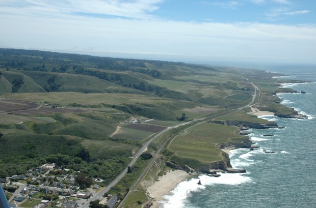
Someone new on the scene recently asked me to explain the history of what went wrong at Cotoni Coast Dairies. After many, many years, the property still isn’t being managed for wildlife or public safety, and it still isn’t open to the public. As a prelude to this, I urge readers to read my essay on how the Bureau of Land Management (BLM) came to manage the property in the first place…a curious story, indeed. This essay compliments that prior essay with more details, especially since BLM took over managing the property. Soon, I’ll be writing the third in this series with suggestions about what is needed to improve this unfortunate situation.
Years of On the Ground Nothing, or Worse
Since its purchase for conservation, Cotoni Coast Dairies has a history of very little stewardship and management. Trust for Public Land purchased the property in 1998 and held it until 2014. During that time, managers working for the Trust for Public Land did almost nothing to maintain the property. Occasionally, someone would show up to clear some anticipated future trail. For instance, TPL contractors extensively cleared riparian vegetation along Liddell Creek, chainsawing decades-old willow trees that shaded endangered fish habitat and provided cover for the endangered California red-legged frog. They argued that the clearance was along an ‘existing road,’ and they started putting this trail on early maps as a favored future public access point. (The trail later appeared on BLM’s maps, but federal wildlife protection agency personnel demanded otherwise, so the trail disappeared from plans.) Otherwise, TPL let fences, gates, and culverts rust away, roads and trails erode, weeds spread, and fuels build up creating hazardous conditions for future wildfires.
In 2014, BLM took over management of Cotoni Coast Dairies, and those same patterns largely continued. Early on, BLM staff constructed a new trail, carving through nests of state-listed sensitive wildlife without required State consultation. Like TPL, BLM staff have either overlooked erosion issues along roads or graded long abandoned ‘existing roads’ (aka ‘future trails’) with uncannily similar detrimental impacts to rare fish and amphibians. Meanwhile, terrible weeds and immense wildfire risks continued to spread across the property. The reason BLM staff have given for such poor stewardship: ‘we don’t have an approved plan.’ That changed, but management hasn’t…except for one new stretch of cattle fence and subset of future trails being created mainly by volunteers. The trails and fence came before any work on invasive species or wildfire mitigation, so we sadly sense BLM staff priorities have been directed away from conservation towards recreational access.
Decades of Funky Planning and Community Engagement
Staff from both TPL and BLM have sporadically spent a bit of time working on poor planning processes or participating in largely perfunctory public meetings about property management at Cotoni Coast Dairies. In the year 2000, TPL convened and facilitated a Community Advisory Group (CAG) to advise on guidelines meant to be used by future managers. A few of us on the CAG were asked to provide feedback about the biological portion of those guidelines, but we were unable to improve the largely cursory and incomplete biological assessments used to guide future property management. It is unclear if those guidelines have ever been used by BLM, or if TPL even cares.
BLM has done little to inventory the property, so it has very poor information with which to plan its management. And so, BLM’s plans have overlooked species and ecosystems that are easily identified and/or previously catalogued by reputable sources. This alienates the conservation community including the wealth of well-trained scientists that this region enjoys.
Instead of the long series of TPL’s CAG meetings, BLM staff have appeared for a very few community-engagement-style meetings, including one early on that was convened and facilitated by the Land Trust of Santa Cruz County. That Land Trust meeting surprisingly and very oddly focused on weighing pros and cons of parking lot locations, but it was never clear why public input was sought or what became of it afterwards. In the midst of this, an outside funder parachuted in hundreds of thousands of dollars so that several local organizations could mount a seemingly ‘grassroots’ Monument Campaign.
Monument Ahoy
In 2015, The Sempervirens Fund led the “Monument Campaign,” a fast-paced, highly scripted, well-funded effort to organize rallies and letter writing to show public support for National Monument designation of Cotoni Coast Dairies. In what is increasingly common “fake news,” the bulk of the Monument Campaign messaging was about opening the property for public use, while in fact Monument designation is more about improving conservation of the property…which would typically increase limitations on public access. This nonsense was compounded by campaign organizers’ refusal to address how designation would increase deed restriction protections already in place from TPL. Furthermore, organizers dismissed concerns about managing the anticipated influx of visitors drawn to something called a National Monument. How important the Monument Campaign was in Obama’s designation is unclear, but the divisions in the community were deep and lasting. Organizers were successful in coalescing well-meaning but very poorly informed people whose nonsensical byline was “Monument designation means my family will be able to visit!” On the other hand, there was a surprisingly politically diverse coalition equipped with well-informed questions and concerns that were never addressed. After that local experience, it is difficult for me to believe that any political faction is immune from using scripted ‘truthiness,’ hype, or even lies when they feel those tools necessary in attracting popular support for secret agendas. Unsurprisingly, leaders of the ephemeral Monument Campaign movement have since disappeared from involvement, leaving the aftermath for the real, long-term grassroots organizations to deal with, and we have yet to experience any conservation benefit of Monument designation.
Pop Up Trail Plans, Abandoned
As the Monument Campaign launched in 2015, BLM issued a proposal for the property’s first public access trail, aka the “Laguna Trail,” in an expedited environmental review process that showed our community how poorly equipped BLM staff were to adequately plan for the property. BLM staff relied on old, insufficient biological inventories for their analysis, failed to survey for endangered species, and did not include any analysis of how the trail would address social equity concerns in providing for visitor use. BLM staff did not respond to the many concerns raised by the public but instead completed their pro-forma circulation and approval of planning documents and rapidly deployed machinery and workers to clear the trail. Trail construction proceeded without conforming to even the nominal environmental guidelines outlined in BLM’s planning documents. The hastily constructed trail cut through state-protected wildlife habitat, degraded historical artifacts, and came very close to a native village site which BLM failed to plan for protecting. In addition, if the project had proceeded, BLM would have opened a trail beginning at Laguna Creek Road and Highway 1 without any new parking, litter, or bathroom facilities, without sufficient staffing for enforcement or interpretation, and without a recreational plan for the property as a whole to analyze how to best protect wildlife while providing public access. This pop up trail was BLM’s way of introducing themselves to the land and to our community.
Introductions to BLM Planning Procedures
As the first federal land manager in the County, it was BLM staff who introduced our community to the federal government’s environmental planning process. This introduction was surprising in many ways. We had been accustomed to public lands managers paying careful attention to protecting “environmentally sensitive habitat areas” (ESHA) according to Coastal Commission rules. Not so with this property – BLM staff didn’t even provide the public maps of those regulated habitat areas in any of their planning documents! With the promise of National Monument protections, we were hopeful that BLM staff would follow the required and highly regimented process outlined in BLM’s policy “Manual 6220,” which provides staff with guidelines on how to manage national monuments. Again, not so! In fact, BLM staff have not used the 6220 manual and have neglected any public acknowledgement of the manual, as if they do not intend to use it, at all. Moreover, BLM staff have never specifically acknowledged the many species and ecosystems protected through the monument designation process. Monument management protocol seems irrelevant to BLM staff, who are apparently bent on expediting the public access so vocally anticipated by the Monument Campaign (coincidence?).
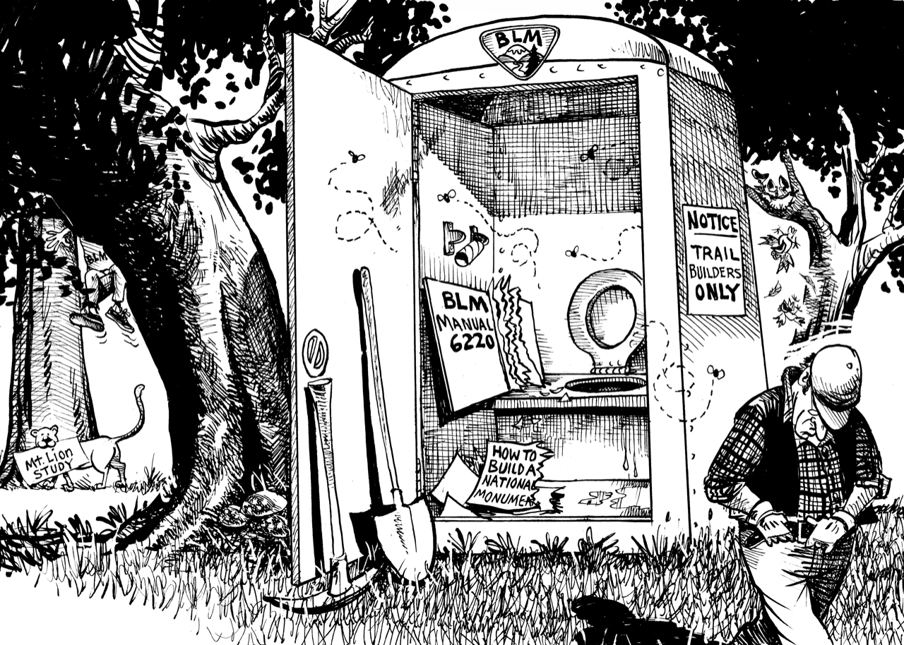
The job ain’t finished until the paperwork is done! Cartoon compliments of DeCinzo, Caption by Grey Hayes
Expediting Public Access
BLM staff have chosen expediency over thoroughness in each of their property planning exercises. For their most recent property-wide plan, instead of data-based predictions of visitor use, BLM staff chose a largely arbitrary low-ball figure of 250,000 anticipated visitors/year for the property. Instead of the logical in-depth alternatives analysis of a full Environmental Impact Statement (EIS), BLM staff have chosen expedited Environmental Analysis (EA) processes, complete with incredible conclusions of ‘Finding of No Significant Impact (FONSI),’ despite significant contrary expert testimony that has gone unaddressed and unacknowledged. As we learned for the first time about its ‘federal consistency process,’ the Coastal Commission recently mandated that BLM use a phased approach to opening the property to public use. The Coastal Commission required that only if/when the BLM proved it could adequately manage public use could it open the full range of parking lots and trails; that proof requires monitoring and such monitoring would normally require a baseline inventory of sensitive natural resources, but we have yet to see that happen…we don’t even know the language to which the BLM and the Coastal Commission have agreed.
Nipping at the Community
My personal interactions with BLM staff have historically been less than pleasant, perhaps because those staff members are unused to much public engagement. My experience of poor interactions with BLM staff isn’t isolated. Someone suggested that this might be partly because those staff feel ‘rocked back on their heels’ because of criticism of their work, which is odd because our comments have been professional, polite, and part of what BLM should expect as public lands planning processes. A BLM staffer told me long ago that their colleagues were in for a surprise as they encountered the very actively involved communities of Santa Cruz County’s North Coast. Previously, most BLM staff working at Cotoni Coast Dairies had worked very much out of the public eye, in remote parts of California with little/no public oversight.
While we can’t ascertain why BLM staff have avoided offers for assistance, their subterfuge is as enlightening as it has been damaging. My compassion about staff feeling rocked back on their heels is limited because BLM staff have sought to discredit my work and harm my reputation, even approaching employers with false information to negatively affect my job while also giving ultimatums to conservation networks to preclude my participation. During one encounter at a public meeting, a BLM staff person told me that they would never collaborate with me or the groups with whom I worked because I was “against any public access at Cotoni Coast Dairies.” That was an incorrect statement about my position that I had likewise been hearing from a particularly activist, radical group of mountain bikers. As this BLM staff person echoed that quote, it was possible to better understand communication channels and allegiances.
My earliest interactions with BLM staff at Cotoni Coast Dairies were when I proposed assistance for biological monitoring. I and a few other biologists offered BLM free assistance with biological surveys to improve their understanding of the property. After that proposal, over a very long time, a BLM staff person strung us along through an incorrect informal process without ever encouraging us or acknowledging the potential value of such work. There was a chain of calls and emails that each ended with something like ‘well, maybe….’ By the time we subsequently discovered the correct application process and applied in that way, leadership had changed and the application was then officially refused.
Cumulative Impacts: Traffic, Trauma, Toilets and Trash (the 4 T’s)
It is important to view BLM’s problems in the context of issues related to visitor access on conservation lands throughout Santa Cruz County. As with all of the other public lands managers, BLM has been planning for visitor use and conservation in a vacuum, as if the surrounding lands don’t exist: this is a deeply flawed perspective. Much of the land from Santa Cruz City to the County line is heavily used by recreational visitors. Most weekends, parking lots overflow with cars and parked cars dangerously line the highway. There are too few trash cans and toilets to serve those visitors. Police and emergency responders are stretched to respond to the many accidents such visitation is bound to create.
County Parks, State Parks, the City of Santa Cruz, the Rail Trail, and BLM each have their own properties to manage and the same 4 T’s issues to address, but they aren’t doing it collaboratively. It is clear that none of those agencies has the resources to address those issues and so those issues are borne by our community. Visitors have come to expect trashy beaches. Emergency responders have come to expect exhaustion and insufficient support. Visitors with elderly family members or small children are avoiding parks due to dangerous or disgusting conditions. As each agency plans in isolation to provide for the maximum number of visitors, parks managers are dooming wildlife and visitor experience – the carrying capacity for the entire North Coast will be surpassed. It is no wonder that our community does not trust BLM to be able to manage their land and the visitors that they plan on attracting. BLM entered an arena of mistrust and fueled the fire with their own mistakes.
Who is Responsible?
Those of you who know me well know I don’t like the passive tense: I like clearly stating the subjects of verbs…who (specifically) is responsible for doing what (specifically). And yet, agencies like BLM are opaque…staff even refuse to specify who is specifically responsible for anything you might witness happening. But, placing the entire blame of the tragedy of Cotoni Coast Dairies on current BLM staff is unfair. Local, state and federal elected officials also bear some responsibility; good intel is that some of them have even winked behind closed doors in Washington DC, saying that local concerns needn’t be addressed. But again, placing a large amount of blame on elected officials also doesn’t seem fair: after all, they should be swayed by popular opinion (or at least election).
We saw how enough funding swayed popular opinion with the Monument Campaign, right? Apparently, no funders have been inspired to sway popular opinion in favor of wildlife protection on conservation lands in this particularly biodiverse region. Even if they did, there is a dearth of organizations who would lead that campaign. And so, in regard to the tragedies unfolding at Cotoni Coast Dairies and across Santa Cruz County’s North Coast, we must bear the brunt of blame within our community, which has long lacked leadership, energy, and focus on environmental conservation. For more on that, read my essay “Democracy and the Environment.” And, stay tuned for the third in this series of essays where I will outline steps forward out of this unfortunate predicament.
-this article adapted and updated from what appeared in late March at Bruce Bratton’s blog BrattonOnline.com
When you visit conservation lands, how do you think critically about stewardship? There are various things to consider and ways you might help.
The Balance
Often conservation lands managers mention their obligation to balance conservation with public access. In our area, this is especially true for State Parks and the Bureau of Land Management (BLM). Here are some Mission Statements to help you understand:
State Parks Mission: “To provide for the health, inspiration and education of the people of California by helping to preserve the state’s extraordinary biological diversity, protecting its most valued natural and cultural resources, and creating opportunities for high-quality outdoor recreation.”
BLM’s mission is “to sustain the health, diversity, and productivity of America’s public lands for the use and enjoyment of present and future generations.”
The normal thing to do when analyzing how to provide a balance between recreational access and conservation is to perform a carrying capacity analysis, which defines ‘limits of acceptable change.’ Monitoring determines if limits are surpassed, and adaptive management reacts with changes to public access patterns to address any problems. If the carrying capacity analysis process were integrated into a collaborative natural resource management program that welcomed public participation, controversies about changing and limiting public access could be managed with more understanding and cooperation.
Visitor Use Expectations
If they followed state of the art management practices, conservation lands managers would consistently determine what prospective visitors expected and adjust to meet those expectations. Expectations are monitored through interviews and surveys not only of people actually visiting the conservation area, but also prospective visitors in the general population. Managers normally encounter a great deal of diversity of expectations from conservation lands visitors. Some want active recreational experiences – trails/roads to jog along or mountain bike; some mountain bikers even want “rad” experiences involving tricky terrain to navigate at high speed on single track trails. Other visitors hope for quiet, contemplative strolls, opportunities to observe wildlife, or safe places to walk with elderly or very young family members. Still other portions of the population want to recreate on motorized vehicles, fly kites or drones, or rock out with parties involving amplified music and dancing. And, other segments of the population want places to meditate, collect medicinal herbs or edible mushrooms, help with stewardship, or take photographs. Obviously, it is impossible to provide everything to all people on any given parcel of conservation land, but how can managers decide what to do?
Meeting Whose Expectations?
Conservation lands proponents are sensitive about meeting many different expectations because they perceive benefits of increasing the public’s support of conservation lands acquisition, which is expensive. Sometimes this is complicated because lobbyists for various recreationally-oriented businesses are good at amplifying their client’s voices to advocate for specific types of visitor use. Traditionally, hunter groups and off highway vehicle organizations achieved successes this way. More recently, mountain biking organizations have been similarly influencing conservation lands management. Proponents of conservation lands acquisition dodge the tricky nature of favoring some types of visitors over others by public cheerleading for ‘maximum public access’ while privately providing pressure for a small subset of visitors, usually those they think are most politically influential. This is why State Parks managers opened Wilder Ranch hiking trails to mountain biking without any analysis or planning, welcomed the public onto the Coast Dairies’ beaches without environmental review, and allowed a private organization to operate a parking lot, gift shop, and privately controlled entrance to Castle Rock State Park. This is also why the Bureau of Land Management will soon allow e-bikes to use trails at Cotoni Coast Dairies. BLM is also planning on crowding all visitors onto trails that will be so heavily used as to spurn contemplative users while disturbing wildlife enough to alienate bird watchers. Families will have their hopes dashed of viewing sensitive wildlife such as bobcats, badgers, and foxes, species that frequent the property before the public has been admitted.
Coastal Commission Cahoots
I would be remiss if I didn’t remind readers that the much-lauded California Coastal Commission has been a close party to such poor ‘maximize public access’ decisions. Politicians have long appointed Coastal Commissioners who agree to the (bogus) ‘maximize public access’ mantra and who consequently believe that protecting nature gets in the way of their political success. Likewise, staff who support this schtick are empowered and promoted…and an organizational culture has been created that knows little else. And so, our beaches, bluffs, and coastal parks are being overrun by visitors, vegetation trampled, hillsides eroding, and wildlife quickly disappearing.
Quality Experience
In our rush to maximize public access, we are losing the quality of visitor experience. Social scientists have long understood that conservation lands visitor expectations can erode based on what is “normal” to experience. As levels of trash increase, people expect trash…and become more careless about leaving trash in natural areas. With poor planning, parks become more crowded, and people lose expectation of contemplative experiences, nature becomes less healing. As over-used, badly managed trails erode into ditches with holes, elderly people stop visiting their favorite places; the average age of visitors grows younger and younger. As poorly educated conservationists work together for the ‘maximum use’ paradigm, families stop expecting to teach their children about wildlife from first-hand observation and the conservation movement loses wildlife advocates.
Oh, But Funding!
Enter into conversation with conservation lands managers with these critiques and the conversation quickly turns to lack of funding as the excuse. ‘We just don’t have the funding to….’ While I am compassionate to lands managers that they face a very dire funding situation, I posit that such poor funding is a result of bad decisions by individuals within their organization and lack of enlightened leadership in the conservation community.
When you hear complaints about funding, I encourage you to ask some follow up questions, like: ‘Have you completed “Carrying Capacity Analyses?”’ ‘Have you delineated “Limits of Acceptable Change?”’ ‘What has your monitoring revealed about the trends of sensitive plant and animal populations on your land?’ ‘How have you managed for changing visitor use and visitor expectations over time?’ If conservation lands managers prioritized addressing those questions in collaboration with the conservation community and the public at large, funding would be less of an issue. When visitor use is curtailed within the collaborative and adaptive management context, there is increased political support and funding for stewardship, planning, and improved alternatives that better address visitor expectations.
What You Can Do
See something, say something. I encourage everyone to speak up and vote for these issues. Any politician at any level must interact with these issues in some way: they should have clearly stated policies that they support to improve conservation lands management. And, they should know the term ‘carrying capacity analysis’ and support the practice as it relates to conservation lands management.
And, if your expectations are not met when you visit conservation lands, you should let the managers know. Are the trails in good shape? Did you see wildlife? Was it too crowded? Did you feel comfortable with the other kinds of users on the same trails? Was there trash? Were bathrooms adequate? Did you and your family feel safe?
Finally, ask conservation lands managers the questions posed above. Also, ask how you might help to manage and monitor within their defined carrying capacity, or how you might then advocate for increased funding for their adaptive management. These dialogues could help immensely.
-this article originally published by Bruce Bratton at his weekly BrattonOnline.com, an invaluable piece of journalism helping thousands of people keep in touch with what really matters around the Monterey Bay area of California. Subscribe today- better yet, donate to keep it going.
I recently came across my 1998 copy of the Pogonip Master Plan and was inspired to share with you some inspiration and interesting tidbits. I find Santa Cruz’ Pogonip Greenbelt an amazingly beautiful place that renews my energy, fuels my curiosity, and, each visit, shows me something new. It is so nice to keep going back to the same places for the last 33 years…to check out favorite trees, familiar meadows, patches of fleeting wildflowers that return each spring, and ancient woodrat houses. Behind this natural beauty is a web of relationships mediated by the City of Santa Cruz Parks Department and guided by the Pogonip Master Plan.
Our Pogonip Vision
In 1991, the Pogonip Task Force formulated the following vision statement for the Pogonip Greenbelt:
Pogonip is a place to be appreciated for its natural beauty, habitat value and serenity, in contrast to the built environment. Pogonip should provide the community with education and recreation opportunities that are environmentally and economically sustainable.
Weighing the Vision
Since 1991 and the subsequent adoption of the Pogonip Master Plan, how have we done with stewardship of this amazing 640-acre greenbelt? In short, we don’t know. There are no publicly available monitoring reports for anyone to understand how ‘habitat value’ has fared or whether people find ‘serenity’ by visiting there. The City’s Pogonip webpage for some reason posts a link to a private recreational organization’s article on the property, which suggests avoiding areas due to dangerous heroin dealers- that doesn’t sound serene to me. We do know that ‘beauty is in the eye of the beholder,’ so judging whether or not that part of the vision statement has been realized is too subjective.
The second part of the vision statement emphasizes sustainability, but nowhere in the document are there any metrics for judging how sustainability might be monitored. One would assume that environmental sustainability metrics for recreational opportunities would include at least soil erosion, wildlife disturbance, and invasive species or pathogen spread.
Updating the Vision
Nearly 30 years later, in 2020 the City created the more recent and very poorly done “Santa Cruz Parks Master Plan 2030” which well reflects the changing nature of City politics…to business-minded anti-environmental politicians. This plan emphasizes Park ‘assets’ – trails other types of development potential of the property – somehow overlooking sensitive habitats that were clearly delineated in the Pogonip Master Plan. It does not provide an updated vision or any new data to help us understand how well Pogonip is faring.
Don’t Yell ‘FIRE!’
The Pogonip Master Plan rightly acknowledges the importance of managing the property for wildfire, prescribing an array of management activities. Search “Pogonip Fire” on the internet and you’ll be able to peruse the many recent fires in that greenbelt. Here’s a list of the 9 easy to find ones:
July 14, 2009 – unknown acres
July 23, 2021 – ½ acre
July 13, 2015 – 3 acres
October 15, 2021 – 2 acres
November 7, 2018 – ? acres
October 16, 2021 – 2 fires, ? acres
June 20, 2020 – 2 acres
June 4, 2022 – ½ acre
November 8, 2020 – 1 acre
Recent Fires in Pogonip’s Extremely Flammable Landscape
Pretty Neat Map
Here’s a map of from the 1998 Master Plan – it has a lot of interesting things on it. First, it illustrates the ways the City was planning on managing the property for fire. Along fire roads, every 10 years the City was going to thin and prune limbs. They were also going to do prescribed burns, mow and graze. They haven’t grazed or done any prescribed fire…and the mowing hasn’t been nearly that extensive.
Pogonip Master Plan’s Interesting Map
It is also interesting to note that there are wetlands mapped in the Upper Main Meadow…right where leaders of the Homeless Garden Project have said that there weren’t any wetlands.
Pogonip and You
This greenbelt property deserves your attention. I advise you to visit and enjoy it – there is a lot going on with wildlife, views, and amazing smells of autumn. You can join the occasional volunteer days to help do restoration- one is coming up on October 29 (email me if you’re interested)! Also, why not ask your City Council members what’s going on with the studies in the Lower Main Meadow- the area slated for the Homeless Garden Project; there were going to be lead contamination studies and a development plan by the Garden folks. Also, you might ask the City what they are doing to assure that the property is safer for fire: why don’t they graze or do prescribed fire…what about more mowing? Finally, wouldn’t it be nice to get periodic updates from Parks on the state of our Greenbelt, including how environmentally sustainable recreation is being managed…and whether the habitat values are improving or degrading?
-this article reprinted from its original location at Bruce Bratton’s online BrattonOnline.com blog- a treasure for our local community…please subscribe, donate/support!
What’s going on with public land management around you, and what are you doing about it?
Most citizens of the U.S.A. state that they want healthy wildlife populations and clean water for their communities and for future generations to enjoy. And yet, repeated surveys of Santa Cruz County residents suggest declining efforts to learn about wildlife so that individuals could take action to protect assure wildlife conservation. We can see this decline also reflected in our activism and politics. When was the last time you heard about an environmental activist group taking a stand to protect local wildlife? Which politician can you name that had environmental conservation as a major portion of their platforms? Have you looked at the agendas or minutes from Santa Cruz County’s Commission on the Environment or Fish and Game Commission – both advisory bodies to County Supervisors? I challenge you to find any evidence of solicited or unsolicited advice to the Supervisors. In short, our County, at the top of the nation’s biodiverse counties, is effectively asleep while their precious natural heritage is being rapidly eroded by neglect. I frequently hear how much Santa Cruzans appreciate the wildlife, the open space, and the natural beauty of this area. If we take these things for granted and do not make efforts to be involved with conservation, I think we know what will happen to these values: they will decline, whither, and disappear altogether with time. It is time to make a shift, and the shift is best focused on our public lands management.
One of the most important things we can do as citizens of this county is to be involved with the management of the public lands around us. There are many ways to be involved in wildlife conservation on public lands throughout the region: volunteering for stewardship, rallying political support for increased conservation on public lands, and supporting environmental conservation organizations. There are three main threats facing nature conservation public lands: changed disturbance regimes, invasive species, and poor management of visitor use. I discuss each briefly in the following and present ways that you might be involved in solution for improved public lands management.
With climate change and increased development encroachment on natural areas, natural disturbance regimes, such as fire and grazing, are rapidly changing presenting a high degree of danger to nature conservation. With climate change, fires are expected to be more frequent and more severe; this is exacerbated by increased human interactions at the Wildland Urban Interface where accidental fires more frequently occur. Likewise, we have removed tule elk and pronghorn and it is becoming increasingly difficult for natural areas managers to use livestock to mimic natural grazing regimes. With both fire and grazing, public lands managers need more public funding to increase their ability to manage natural systems. There needs to be more public outcry and support for both funding and expertise within those agencies to improve lands management. Those kinds of support are also important for invasive species management. A different kind of support is needed for better management of natural areas in the face of poor visitor use management.
Badly managed visitor use in natural areas is a major cause of concern globally for nature conservation, and locally this seems to be nearly entirely ignored. The most glaring evidence that this is a problem is the nearly ubiquitous and unquestioned philosophy that increased access to natural areas is an important goal for nature conservation. Look carefully around our local parks agencies and you’ll also notice that there are no personnel trained at managing the conflict between nature conservation and visitor use, the field of study necessary to assure nature conservation in parks. The most recent planning effort for visitor use in a public park was with the BLM’s Cotoni Coast Dairies property, a real disaster in public process with recreational infrastructure development proceeding apace despite an active and unsettled legal appeal by a very small of citizens who have seen too little community support. Of the many larger, environmental groups in the area, only the Sempervirens Fund has offered publicly stated concern…”Important details remain to be determined and we look forward to working with BLM to resolve them.” For the grave impacts to nature from visitor use in natural areas, there seems to me to be a need for a fundamental shift in both public perception and in the public lands management agencies to better recognize and address this issue. The following section outlines some actions you can take to help this process forward.
There are many ways, big and small, for you to be more involved with the paradigm shift needed to better address the serious issues surrounding visitor use management in natural areas. First and foremost, many more of us should become educated about the science documenting the concerns and how those concerns are addressed through social and environmental carrying capacity analysis and adaptive management. Social carrying capacity analyses define the limits of acceptable change from visitor use conflicts: conflicts between different types of uses (for instance, mountain bikers vs. passive recreational use of families with children) or conflicts due to overcrowding. Ecological carrying capacity analyses define the limits of acceptable change for soils, biota, or other natural phenomenon (for instance, amounts of trail erosion, wildlife such as cougars that are easily disrupted by visitors).
Another thing we can do to help the situation of poor visitor use management in our parks is to advocate for improvement. We should tune our senses to notice negative impacts of visitor use and then aim our activism towards change: make formal reports of issues to natural area managers, follow up on those reports, and also message higher level administration, commissions overseeing those agencies, and politicians who are invested in agency oversight. Persistence will help. Let’s also vote for politicians who promise to help. And, let’s support environmental groups who promise to work on these issues. Finally, many more people who care about these issues need to be involved with public lands management planning. Currently, mainly exploitive and well-funded non-passive recreational users are organized and vocal during these processes (i.e., Outdoor Industry Association funded groups like mountain biking advocates). Meanwhile, traditional conservation groups like the Sierra Club and Audubon Society have shied away from such issues due to either controversy or co-option. We need a new group or need to sway old groups to take these issues on.
-this article originally appeared at Bruce Bratton’s weekly BrattonOnline.com If you haven’t subscribed, I recommed it: “The last great news sources of Santa Cruz.”
Five shovels, five rakes, and ten of us sweating and smiling as we worked to restore trails in UCSC’s Upper Campus Natural Reserve. For a few years in the mid-1990s, UCSC undergraduate volunteers joined me, Campus Reserve Steward, one Saturday a month to reverse the harm that hundreds of mountain bikes were causing. We spent the most time along 7 Springs Trail and the Interpretive Trail. Both trails were off limits to bicyclists and clearly signed; they still are. These are very sensitive ecological areas replete with wetlands, springs, and highly erosive soils. They have been set aside for teaching and research, visited by classes and sites of long-term forest research. While we worked, we frequently encountered bicyclist after bicyclist, some skidding to avoid hitting the volunteers. Our team was trained and eager to inform the bicyclists about the trails being closed and why. More than half of the bicyclists were aggressive and unfriendly, unwelcoming to such an interaction. We were yelled at, called all sorts of names, and there were occasional threats of violence, and even spitting. I was thrown to the ground and stepped on once by a particularly aggressive individual. Our work to close the trail was regularly and expertly vandalized and signs frequently defaced. This is a dominant culture of mountain biking. These instances are not outliers, the behavior far too common. I have been hearing similar stories from many people for years. Once, I told a person with his son that I would call a ranger if they jumped a gate headed into a closed, sensitive natural area. He responded, “I AM A RANGER!” And I recognized him as one of the head rangers for State Parks…and off he went, a fine example for his son.
Givers Vs. Takers
I recommend reading Daniel Quinn’s book Ishmael; one of the things I recall from the book is a characterization of humans as being either “givers” or “takers.” Santa Cruz County has been fortunate to have a historic giving culture. A very large percentage of the County has been set aside as parks or is stewarded by large private landowners who take very good care of their land. There is little area for urban sprawl, but now we are facing the next biggest threat: natural areas recreation, one of the top threats to biodiversity on the planet. Leading the assault are trails advocacy groups, some of which have been at this for decades. There will apparently never be enough new mountain bike trails for the funders of these groups. These groups and others like them around the world are being funded by industry through organizations such as the Outdoor Industry Association. Mountain biking trails-building volunteers working for these advocacy groups are spending their free time expanding corporate profits while repairing a small fraction of the damage they’ve collectively caused with their thrill-seeking sport. These are what Ishmael would call ‘takers.’ Together, mountain biking (aka ‘trails’) advocacy groups and the outdoor recreation industry are pressuring every public land management agency in the Bay Area to expand mountain biking trails in an apparent bid to turn every inch of natural area into a high-speed playground, maximizing profits at the expense of the wildlife and the quiet walks once enjoyed by families with small children, bird watchers, and contemplative hikers. On this subject, someone urged me to consider Hanlon’s razor: “Never attribute to malice that which is adequately explained by stupidity.”
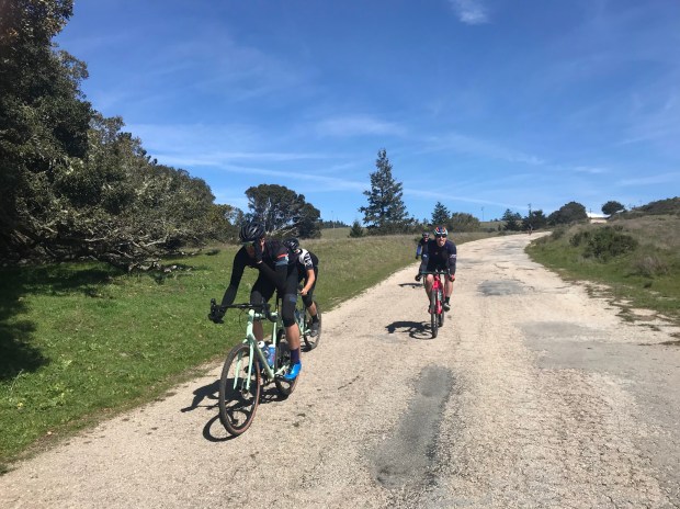
The Corruptors’ Rule: Keep Them Stupid
I suspect that a fraction of those building new trails at Cotoni Coast Dairies innocently think they are doing the right thing. The groups organizing these events certainly won’t educate the volunteers about the dubious nature of their work. They won’t share with them the long and expertly crafted critiques of the park’s planning process by the region’s leading biologists. They won’t tell the volunteers already riding mountain bikes on the trails that a broad coalition of conservation groups oppose using the trails before a biological baseline is collected. They won’t tell the volunteers that their sponsoring group has, without expertise, testified in contradiction to conservationists during the planning process in an apparent bid to gain points, and a sole-source trail building contract, with the BLM. The volunteers, knowingly or not, have become active participants in the commodification of nature. So, they are “takers.”
Our Chance
Conservationists (aka “givers”) point out that we have a once-in-a-lifetime opportunity at Cotoni Coast Dairies to collect a biological baseline before trail use commences. With this baseline, we can better understand how trail use affects wildlife, plant communities, soils processes, and the spread of invasive species. The property has been very lightly visited by humans for more than 100 years. Because the property is designated as part of the California Coastal Monument and as part of the federal National Conservation Lands network, there are extensive policies that support and even require such a baseline…this level of policy support is absent with any other conservation land in the County. Do the trails building volunteers know that, through their work, they are supporting BLM in shirking critical land conservation responsibilities?
Snap!
I have put these arguments to volunteers of trails groups working at Cotoni Coast Dairies and have been reminded of a series of fallacious arguments that have been trotted out for decades. The most common statement is: “It’s a done deal, trails were approved and are under way, get over it!” This statement ignores the ongoing and active appeal to the planning process by a coalition of conservation groups. And, even without such an appeal, the statement overlooks the need to manage trails forever and land management agencies’ responsibility to adaptively manage trails to avoid impacts to protected natural resources and user conflicts that would favor certain user groups (such as mountain bikers).
Avoid the Trap
In a bid to trap the unwary, some of the leaders of the trails advocacy groups have suggested that their groups are ‘conservation’ groups. If you are confused, ask the leaders of these groups about what is ‘enough’ and what is ‘too much?’ For instance, when will there be ‘enough’ mountain bike trails? What specific metric would indicate too much soil erosion on a given stretch of trail? What, specifically, is too much user conflict- such as how much displacement of families with small children who fear their 3-year-olds getting hit by mountain bikes (like one person recently reported to me)? How specifically will we know when there has been too much wildlife loss due to natural areas recreation? If the trails advocacy group truly had a conservation platform, they would have answers, created through methods of carrying capacity analysis and they would be able to offer threshold limits of acceptable change (‘enough’ or ‘too much’). I have long interacted with these groups, and this is where I see evidence favoring ‘malice’ instead of Hanlon’s razor ‘stupidity.’ With this kind of experience, one might discover which groups are primarily interested in the commodification of nature, and are, thereby ‘takers.’
Past Evidence
In the 1990’s, one of these trails advocacy groups began their ugly but organized, well-funded campaigns to expand mountain biking trails in this region. I was at the table when the group negotiated the opening of the U-Con trail from UCSC to Henry Cowell. They promised volunteers to close and keep closed the myriad of unsanctioned trails bleeding tons of sediment into the San Lorenzo River; they said that they would post volunteers at trail heads to “self-enforce” closure. They did no such thing. I was also there when mountain biking representatives showed up at the first Gray Whale Advisory Committee meeting, having worked with State Parks for a year to prepare detailed plans for an extensive network of new trails through that property (now part of Wilder Ranch State Park) without any understanding of/interest in the extensive areas with sensitive ecology and erosive soils. Because of their intransigence at coming to agreement with Parks and the Committee, there is still no long term trails management plan and no plan for protecting critical sensitive species. A group consulted with me when Nisene Marks State Park General Plan was being drafted and mountain biking advocates were aggressively advocating for more mountain bike trails, in contradiction to permanent deed restrictions against such use….wasting extensive State and private resources and, once again, needlessly dividing our community. More recently, I countered a mountain biking group publicity campaign that sought to educate the public falsely about the ‘need’ for more mountain bike trails because of the purported paucity of such in the County. After correction, they walked back the campaign and it subsequently disappeared. These situations are, in my opinion, more evidence of ‘malice’ rather than ‘stupidity.’
We are Winning
Despite all of this, the ‘givers’ are winning, pushing forward protections for Nature in parks around Santa Cruz. We realize that the vast majority of us want healthy wildlife AND access to natural areas where we can recreate without fear. We reject the politics of division that those whose object is the commodification of nature so enjoy. Together, we won protections for Nisene Marks State Park. We expanded protections prohibiting mountain bikes in extensive wilderness areas of Castle Rock State Park. We created extensive Natural Preserves at Wilder Ranch State Park, thwarting miles of new mountain bike trails. We have (thus far) maintained prohibitions against mountain biking on single track trails at UCSC. A coalition of conservation groups has recently made great headway in improving the poor recreational planning at Cotoni Coast Dairies. With community support, the San Vicente Redwoods conservation coalition is enacting the most progressive recreation and conservation adaptive management regime our region has ever seen. Expanding awareness even forced one mountain biking advocacy group to change their name to seem more PC. And soon, we may have Congressional representative Jimmy Panetta instead of Anna Eshoo- a massive step forward in leadership to better manage the impacts of natural areas visitors to our communities and to wildlife. I have been fielding so many requests to help on these issues that I can’t keep up. Together, we are turning the tide: there is hope that future generations will be able to enjoy peaceful strolls and see sensitive wildlife in our natural areas, after all.
Your Time
Meanwhile, when you consider how to spend your outdoor volunteer time, focus your attention on groups that know how to help you to truly become a ‘giver’– groups like the Peninsula Open Space Trust, the Land Trust of Santa Cruz County, and the California Native Plant Society.
-this essay originally published in Bruce Bratton’s weekly blog BrattonOnline.com
We face a quandary for which there are many solutions: the northern region of Santa Cruz County is one of the nation’s top biodiversity hotspots which is increasingly facing one of the largest threats to biodiversity – recreation within conservation areas. Globally, the coast of California is recognized as one of the most important crisis areas where natural areas tourism impact overlaps with critical conservation areas called biodiversity hotspots.
Biodiversity Hotspots
Biodiversity hotspots have been scientifically catalogued in precise ways to direct conservation funding and activities. These areas have particularly high numbers of species limited to small geographic areas, correlating with large numbers of endangered species. Areas with numerous endangered species in different groups receive higher hotspot scores: Santa Cruz County has many endangered species in three groups: ‘herptiles, arthropods, and plants,’ and so is one of only two counties in the nation to receive the highest hotspot score. Similarly, with a larger lens than county boundaries, the San Francisco Bay Area, including northern Santa Cruz County, is recognized as one of the top three biodiversity hotspots in the country. The rationale for using biodiversity hotspot indices for conservation prioritization is so widely accepted that this measure has become the focus of the most funding of any other conservation initiative, a total of $750 million up to 2010. Our region has long benefited from such largesse, including the generous funding to set aside areas like the BLM’s Cotoni Coast Dairies and POST/Sempervirens Fund’s San Vicente Redwoods conservation areas. And yet, purchasing of land for conservation purposes only begins the process of conservation, which will last many lifetimes. Fortunately, there are many strong protections in place for these areas that help to guarantee that they will long be managed primarily for biodiversity protection.
Wildlife Protected at Cotoni Coast Dairies
There are a host of guarantees for biodiversity protection at the Cotoni Coast Dairies property. In 2017, Obama’s presidential proclamation making the property a part of the California Coastal Monument there are protections for such a breadth of ‘Objects of the Monument.’ Monument designation carries with it mandates for very careful planning, inventory, and adaptive management to assure natural resource protection. In addition, the property has been designated as part of the most protected lands in the Country: National Conservation Lands. In addition, BLM maintains and regularly updates lists of ‘special status’ plants and animals to guide protections on their lands. For those interested in mandates for BLM management for biodiversity on National Monuments, I encourage perusal of their Manual 6220. Using one ‘Object of the Monument’ as an example, the 6220 Manual requires that BLM inventory the dusky footed woodrat on the property and, in collaboration with experts at its National Conservation Lands Office, include in its property-wide science plan specifics about how managers will monitor and adaptively manage the property to assure the species’ protection. Regulations protecting biodiversity on the nation’s highest value conservation lands well reflect the majority of citizen’s interests in protecting wildlife, even if it means personal sacrifice. This is good news for conservation in natural areas because of the natural conflict between recreation and conservation.
Recreational Use is Contrary to Wildlife Protection
There has been much published about the negative impacts to wildlife of recreational use in natural areas, but here are a few illustrations of types of negative impacts. The following species are listed as “Objects of the Monument:” gray fox, bobcat, and mountain lion. Predators such as these three species are well recognized as extremely sensitive to recreational use in natural areas, leading to decreased density and abundance of these types of animals. Researchers working in the Santa Cruz area have noted that mountain lions are substantially sensitive to noises from humans, which reduce their use of recreational areas and lead to changes rippling through the rest of the wildlife community, including increased numbers of mice and potential increased frequency of Lyme disease. But, mammalian predators aren’t the only types of wildlife to be disturbed by recreational use.
The Monument Proclamation also calls out protection for Wilson’s and orange-crowned warblers, downy woodpecker, tree swallow, Cooper’s hawk, and American kestrel. Burrowing owl, golden eagle, tricolored blackbird, and white-tailed kite are also listed as protected on BLM’s special status animals list for California. Some bird species have been shown to be especially ‘flighty’ in the face of recreational use, requiring study and specific trail design to adequately buffer distances to avoid impacts. While the effects on specific species varies, some species can be negatively affected by the mere presence of humans, so, unless specific studies can ascertain effects, scientists suggest that avoiding new trails in natural areas is the best measure for conserving sensitive birds. Grassland birds, such as the burrowing owl, are particularly sensitive to recreational disturbance, perhaps because it is so difficult for these species to hide. There are also studies that would suggest care must be taken to avoid recreational disturbance to species like the California red-legged frog, deer, and native plants.
BLM’s Dilemma
BLM managers of Cotoni Coast Dairies face the many dilemmas of managing land for conflicting visitor uses alongside the conflict between recreational access and nature conservation in an especially sensitive ecological area. The varying types of recreational users run the gamut from mountain bikers who use trails for the physical thrill of staying upright with speed and obstacles…to more scenery- and/or exercise-oriented mountain bikers and hikers…to more passive recreational users such as wildlife viewers…to photographers and painters…to restorationists…and scientists of natural history. Each user group conflicts with the next and the ones further apart with their expectations conflict even worse. I have not seen a plan by BLM to accommodate or monitor such conflicting uses, which will lead to what is called displacement, mainly of families with children and more passive natural areas users. Instead, BLM managers have shown a personal and strong affinity with the mountain biking community, which is also the agency’s closest ally in advocating for and developing recreational trails designed for their use on the property. On the other hand, BLM managers have turned away from engagement with passive users such as wildlife viewers, restorationists and scientists of natural history. Without welcoming this engagement which would have made up for their professed lack of such capacity, BLM managers are now moving forward with little understanding of the distribution and abundance of species, including those protected by statute. The evident BLM managerial-mountain biking community conflict of interest should be a great concern of those of the public who are concerned with biological conservation.
The Collaborative Management Solution
We should be advocating for an alternate way forward where BLM public engagement staff serve as facilitators of solutions-based approaches to the conflicts between users and between recreational use and natural resource conservation. The first step would be for BLM to adhere to its policy requiring a science plan informed by a baseline inventory of the Objects of the Monument and other special status species; this plan would include a carrying capacity analysis and an adaptive management framework to assure protection of the resources. All of those steps could be done collaboratively with scientists and volunteers as is outlined in BLM’s policy guidance. There have been offers for substantive financial resources to assist with this planning. Instead of hiding its scientific studies as it does now, BLM would proudly share what science it has gathered on a public interactive website. Once completed, the science plan could then be the focus of collaborative management of the property including all interested parties working together with the common goal of conservation of biological diversity while providing recreational access to the maximum extent possible. We are lucky to have a coalition of many groups working to make this vision real, including: Rural Bonny Doon Association, Friends of the North Coast, Sempervirens Fund, and Davenport North Coast Association. Your support of those organizations will help greatly.
-this post originally appeared last week in my weekly column at Bruce Bratton’s weekly BrattonOnline.com
Imagine you are a mountain lion, a badger, or a burrowing owl making your way around our region. Curiously, people often say, ‘I can’t imagine,’ but I contend that our imaginations are more powerful than that. We can imagine a lot if we have enough information to work with and give our minds the room to roam. We can put ourselves in the place of other species if we want, but only if we can face the pain that such empathetic contemplation may bring. We have left wildlife so little, but we have the power to restore healthy populations of wildlife for future generations.
Big Clever Cats
We have the great fortune to share this landscape with wild lions. To put yourself in the lion’s mind, imagine being a young male learning to walk from Aptos to Scotts Valley, getting across roads, keeping away from people, trying not to make their dogs bark, and staying under constant cover of forest. That young lion will also be learning, by scent, where girl lions are and where other murderous males have claimed territory.
Cat Map
Lions know how large to guard territories against one another to keep sufficient food for their families. Fresh deer are needed, one a week for each mature lion. A human hunter would be challenged to keep that pace up; it takes a lot of roaming. Mountain lions move under cover of trees, they shy away from moving around in the open if they can help it. They travel tree filled canyons, wooded ridges, and trails through the forests. To them, those places are like our road network- they must make mental maps as quickly as their young minds can do it, and those maps must keep receiving layer after layer of new information – especially where other lions prowl.
Badger
Two weeks ago, I was very pleased to find many badger-dug burrows in grasslands along the North Coast. Badgers look at the landscape in the opposite way that a mountain lion might. Where lions see woodlands as their comfy place, badgers prefer grasslands – maybe in part because of the lions in the forests! To imagine moving around the landscape like a badger, think about walking from the grasslands above Watsonville to the grasslands along the North Coast by staying mainly in grasslands, each night digging a burrow to sleep in, finding enough gophers and ground squirrels to eat along the way, getting across roads and never being seen by a human. That’s some tough going!
Burrowing Badgers
The burrows I saw were not fresh, and I couldn’t find a den. The badger foot tracks had been washed entirely away by a prior pouring rain. Probably this was a wandering individual, who kept moving after staying for a few weeks. Males disperse widely – even through forests. Someone was surprised to see a photo of a badger on their wildlife camera in a north coast redwood forest a few years back. I haven’t heard of anyone finding a badger burrow in a forested area.
Like vampires, badgers must be underground by daylight. Digging burrows is best done in sandy soil. And so, badgers’ mental maps include not only the network of grasslands, but also the subset of grasslands with homey sandy places where they can easily dig for food or make burrows.
Santa Cruz Badgers: Gone
There used to be badgers near Santa Cruz, not that long ago. They still occasionally happen through. When UCSC’s Chris Lay compiled local badger sightings and analyzed this species’ local disappearance, he concluded that roads explained badger demise. Roads are a big challenge to badgers. The frequent median barriers popping up on local highways have been important in saving human lives, but to badgers they are sure death. Conservationists in Great Britain, where badgers are held in perhaps higher esteem than here, have gone to great lengths to make sure badgers are now able to cross highways – laying down fences to guide badgers to the safety of underpasses.
Burrowing Owls
Burrowing owls probably see the landscape much like badgers- their homes are also in grasslands. Unlike badgers, though, burrowing owls navigate landscapes on the wing, so maybe roads aren’t so lethal. These wide-eyed, cute, bobbing, yellow-legged owls also used to frequent the meadows near Santa Cruz, but the last nesting colony was paved over by the administrators of UCSC. Now, burrowing owls are wintertime visitors only, travelling from their summer nests in inland grasslands. I wonder if burrowing owl families that once nested along the coast remember their coastal habitats and have been leading one another back to the warmer coastal grasslands each year?
Owl Trip
To imagine a burrowing owl flight to the coast, you’d be starting probably in the grasslands east of San Jose. As the nights get chillier and shorter, something in your burrowing owl mind makes you want to fly towards the coast. One long flight across the buzzing Silicon Valley city scape blanketed by nasty air pollution and you might land in one of the few remaining grasslands on the east side of the Santa Cruz Mountains…. or you might keep flying all the way to the coast. This flight would be different than most of your flights all summer long, which have been much shorter. While you are taking this long flight, you keep alert to the increasing threat of peregrine falcons…listening for the alarm calls of other birds. As you get towards the coast, you feel anxiety as each year the available habitat has been reducing: will you find a place with good cover for the winter?
Coastal Burrows
A month or so ago, I went to UCSC’s East Meadow to see burrowing owls but couldn’t find any sign of them. I looked for the owl’s wintertime homes, but they were gone: the many ground squirrel burrows in the East Meadow are gone and I couldn’t find any. In fact, there were no ground squirrels AT ALL! Anyone know what happened to them? Please let me know if you do. Long ago, UCSC administrators destroyed the last burrowing owl nesting area in the County, and more recently they destroyed the burrowing owl wintertime burrows at Terrace Point, so I’m suspicious about this new loss. Now, the UCSC wintering owls must join their friends to hide in culverts or pipes along the North Coast for their winter homes.
Linkages
“Progressive” Santa Cruz is working on its first project expressly acknowledging the need for wildlife movement across this landscape, but much more is needed, and we can all help. Informed by much science, the Land Trust of Santa Cruz County is working on creating a wildlife tunnel near Laurel Curve on Highway 17. To work, the land on either side of the tunnel must also be wildlife friendly. This corridor is in a wooded area and designed especially for mountain lion movement…maybe badgers can find it, too! Further South and East, groups are making great progress at protecting the wildlife movement corridor between the Mount Hamilton Range and the Santa Cruz Mountains through the Coyote Valley. This corridor relies on existing bridges under Highway 101 and also envisions some improved crossings over the Monterey Highway, which has median divider in many places. Badgers need this corridor to get to our region, but many other wildlife species could use this corridor- maybe even tule elk! These efforts need our financial support. We can also help wildlife movement by supporting better planning for protected wildlands, such as opposing the Homeless Garden Project’s newly hatched plan to move into the Upper Main Meadow of the Pogonip…or the seemingly continuous push to increase the numbers of trails crisscrossing parks. I hope you will take some time to imagine how your favorite species of wildlife travels across what’s left of this highly fragmented landscape… and how you can help restore the landscape we all need.
This essay reprinted from the one I original published via Bruce Bratton at BrattonOnline.com
Fellow citizens of Santa Cruz, we have done so much good for the environment. We are transforming our city into a bicycling mecca, and our entire region will soon be powered by mostly renewable energy. Hundreds of volunteers work hard to keep our many beautiful beaches accessible and clean. We recycle and conserve water at unprecedented rates. Our culture strongly supports organic agriculture, and we purchase local and organic foods at a plethora of organic grocers and farmers markets every day of the week. And, we have supported leaders who found the funding and partners to protect thousands of acres of parks and open space across our lovely hills.
So why is our community welcoming the destruction of the City of Santa Cruz’ greenbelt?
The City’s Greenbelt has been a great environmental accomplishment. For a while, our City was circled by open space, and we nearly connected the pieces – from Natural Bridges State Beach to Antonelli Pond up to the Moore Creek Preserve and onto UCSC’s meadows, across Pogonip, down into Henry Cowell and Sycamore Grove, up onto De La Veaga Park, and down the creek to Arana Gulch and the Harbor. We worked well together to make that happen. Different people had different goals for supporting our Greenbelt: improving property values, protecting water quality, preserving nice views, protecting wildlife, creating recreational opportunities, limiting urban sprawl, and giving our children natural places to learn and grow.
Setting the land aside has been the easiest part of reaching our greenbelt goals. But, the greenbelt is relatively new – it is in its infancy – and Santa Cruzans are proving poor stewards.
Neighbors complain that greenbelt areas are messy homeless encampments, harboring unsavory elements and even criminals. Trail erosion, pavement, fires, and trash in greenbelts pollute our streams. The pleasant views of the greenbelt are being transformed though crowds of users, buildings, recreational infrastructure- fences, roads, signs, and parking lots- all of which is destroying wildlife habitat and scaring away what critters are left. For those who would enjoy the parks, planners with little capacity are trying to provide for all types of recreation, assuring degradation of the quality of all recreational experiences. The greatest number of those who would use the greenbelt for generations to come are those seeking peaceful, passive, family recreation. That potential is rapidly disappearing – our children’s children will have to travel further from home to enjoy quiet nature experiences, healthy wildlife, or clear-running streams.
How did the Greenbelt end up in this mess?
Organizational and individual leadership and capacity has been lacking to preserve and steward the Santa Cruz Greenbelt. The agency responsible for oversight of the greenbelt is the City of Santa Cruz Parks and Recreation Department; its mission is ‘to provide the best facilities, recreational cultural and parks programs.’ The agency is understaffed and mostly focused on safety, aesthetics, and maximizing recreational development. Greenbelt conservation then falls to nonprofit advocates- friends groups and larger environmental organizations. Pogonip Watch and Friends of Arana Gulch are important. Volunteers with the California Native Plant Society work hard to raise funds, educate our community, pull invasive species, and are focused on a few mostly long-term conservation issues. But, they can’t do enough. The local chapter of the Sierra Club has had difficulty addressing much local nature conservation as well, and greenbelt issues have divided the group.
Meanwhile, well-funded and organized special interest groups are succeeding in transforming the greenbelt to benefit a small fraction of our community. A passionate bicycle transportation community along with lucrative mountain bicycle businesses are succeeding in carving up the greenbelt, criss-crossing it with high-speed recreation and transportation corridors. Organizations hoping to make some small improvements with homelessness issues are converting 9 acres of Pogonip’s wildlife habitats to agriculture; they hope also to have a permanent homeless encampment there, as well. Sports enthusiasts are working to transform still more of Pogonip to ballfields.
These special interests join the City of Santa Cruz and most other regional leaders who seem to believe that more is better when it comes to extractive use of natural areas, including the Greenbelt. Here are three bars of their collective public relations tune:
The greenbelt works best when it serves the maximum number of people and types of uses.
Legitimate use of the greenbelt drives away unsavory use.
If we don’t maximize use of the greenbelt, people will stop caring about preserving nature.
These three statements are false.
We need to support organizations and leaders that will expose these falsehoods and work to preserve the greenbelt for future generations.
To solidify our commitment to a greenbelt that supports wildlife, clean water, and passive recreational enjoyment, our greenbelt areas need to be protected by conservation easements enforced by third party organizations. Only then can our greenbelt be protected from the special interest groups which will inevitably garner political support until nothing is left.