Sideways rain washed the windows clean this past week. Well, sometimes it blew the screens clean, depositing the early season dust and pollen onto the adjoining windows. For a few days, trees and shrubs did their crazy wind dances, nodding and bowing and whipping and shaking. It was a sporadically blustery and showery affair, mainly. Towards the end of the storm, there was sunshine in between the gales and rain and…rainbows! So happy to get a bit more rain. It seems to have (re)wet the soil, which had dried two feet down. A big sigh of relief, giving us more time to get the orchard irrigation up and running again without the trees wilting (like last year!).
And, it’s been cool, again. A few nights in the mid-forties. The woodstoves were at work keeping our dwellings warm.
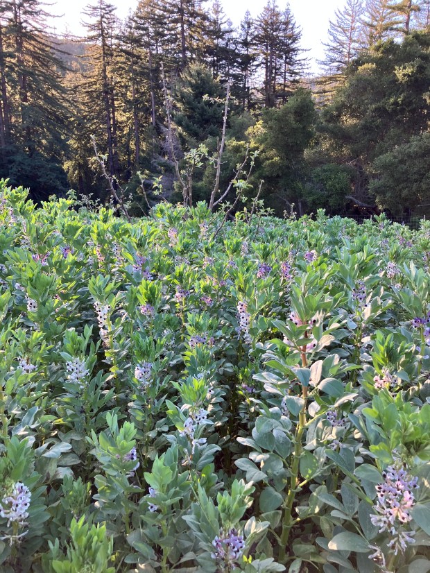
Fabulously Flowing Bell Beans – building soil and providing pollinators happiness
Active Critters
The first squirrel started squeaking this past week, joining the crickets and birds with the high notes. Western bluebirds sure are bright and particularly vocal. Song sparrows are also very song-y. I saw one picking seeds off of grasses in a fallow field – it was very shy and jumpy-nervous. There are innumerable robins posted across the farm. Maw and Caw chased two interloping ravens recently: that was a noisy air battle – noisy, but not long lasting. Perhaps they were just saying ‘hello!’ In the past, there has been less aggressive interactions, which I assumed was one of the offspring bringing a mate back ‘home’ to meet the parents. This was different.
Fox and bobcat have been frequently sighted by various neighbors. One very young bobcat is wandering the road just onto our property at the top.
Greenhouse
The Two Dog Farm greenhouse is vibrantly full of baby plants. There are large tomatoes looking ready for the ground as well as lots of other things. It is the drum roll to planting time.
Orchards
Each Spring presents a mandatory 40 hours of mowing, but the run up is quite beautiful. The artistry of cover crops is overwhelming: lush, flower-filled stalks of bell beans are more than 5 feet tall where they are still growing. Some areas are already mowed, stubs of bell beans sticking up, crunchy-green still. Between those stubs, mushy ground up plants, sometimes stinky-rot, black slime. Patches of mown radish grounds present a particularly unseemly brassica stench. Between mowing sessions, I wander into the uncut cover crop, appreciating the ranks of lush flowers, the fleshy leaves, and the impressively thick shoots.
Bell beans, apple, and distant hillside
Fire!
The last bit of backyard burn season is upon us and folks around the farm have been burning accumulated biomass in piles. Alligator lizards snake away from the stacks of branches that we move one-at-a-time into an adjoining flaming pile. Burning in the rain is particularly exhilarating…if you can get the piles started. Bright poppy orange flames counter the graying dusk. The following morning presents an ash pile with satisfyingly little left unburned.
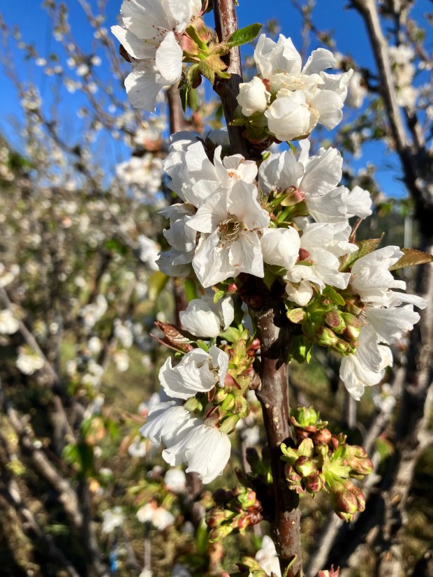
It is stupendous and so very fleeting – a grove of cherry trees in bloom. Buds swell quickly, then bare branches soon festooned with pure white petals unfurling. Almost immediately the flowers fade, carried on the breeze, carpeting the ground. Just as rapidly, leaves emerge, grow, and fill the canopies of the trees: fresh, thickly green and lush. New shoots are next, poking into unoccupied voids to capture sun and feed the juicy dark red fruit.
Cherry Trees are in Bloom!
Watering
Cherry Hill, like all of the orchard areas, needs water, NOW…a month early. The microsprinklers and irrigation tubing need uncovering, tested for leaks, pressurized and flushed….2 sprinkers for each of 400 trees, a mile of tubing, hundreds of feet of hard plastic pipe and so many risers and valves. Over the winter mice and gophers have chewed holes, errant mowers or hoes have compromised irrigation: all needs fixing and fast for the thirst of the trees. Marty and Mike chipped in and covered the largest patch of orchard, and I follow to the next places – only 4 more hours to go until irrigation is wetting the soil in all orchard areas! The sun is shining…the pumps are pumping…all is wonderfully waterish well.
Winter Crops
Mostly, the fields are making ‘green manure.’ Cover crops are nearly all in full bloom, making for beautiful color. Head-high yellow mustard is the eye candy from Molino Creek Farm – with an understory of daikon radish: mow that stuff and the roughly chopped remains smells very rich (!) (rank?) as it rots. It is better left tall and flower-filled and habitat for redwing blackbirds a’plenty. In the orchard, the wet, thick stalks of bell beans are festooned densely with flowers, leaves wilting as the soil dries. Oats and vetch are lagging portions of the cover crop: flowers still to come, they are the understory or sometimes the overstory when in stunted, poor-soiled parts of fields.
Tall mustard and Daikon radish – big cover crops inviting nesting birds
Coyote, Turkey, and Quail – Oh My!
Coyotes have gone quiet – a sure sign that lions are near! Wild dog turds are commonplace along trails – that’s how we know they are here. But, they are tip-toeing, nose to the wind, sniffing the big kitties, trying to keep one step ahead. Turkeys – way less bashful. Two toms have been frequently flashing their huge tails, puffed up, dragging their dirt-drawing wings, drumming. Their fleshy head parts are very impressively flashing purples, blue, and crimson. Hens are unimpressed. All are pecking at grass stalks, picking off the first seeds. They take to air easily, flying into the woods, across fencelines. I counted 140 quail in one covey, crowded along a freshly mown road. The big group or smaller all seem particularly skittish right now- what’s up? This ground created lots of quail last year – we’ll see how this year’s eggs hatch. They aren’t paired up yet, so chicks are a long ways off. I saw a finch feeding a baby today, though- early? odd!
Human Stuff
The diggers found the pipe break. Mowers are mowing. Grape growers are fencing. The soil is getting ‘worked up.’ We are trying to discern why one would run a trencher so crookedly, but they did. Every 10 or so feet: an elongate hole was excavated until the pipe was encountered. Then off in the approximate direction for the next hole. From the water pressure, we knew the pipe broke at around 6’ elevation above the well head, and Sylvie’s measurement put that up near the fence/road…but had to trace the pipe to that point and then, YES, that’s where the pipe burst. We’re in business again- the well is pumping to the tanks once again and all is happiness and satisfaction.
With the long days, drizzle, and mucho sun, things need mowing. Mowers are stretched. Already two of the six mowers are down. Thanks to the generous gifts last year, the Community Orchard has its very own mower and it is working quite well: there are 20 hours of mowing to do in the orchard in the next few weeks! Chipping away by the day.
The solution to elusive in-fence deer: build an interior fence! Two Dog is putting a fence within a fence – fencing their vineyard. Beautifully aligned, white-tipped T posts stand in long lines awaiting the fencing.
Speaking of Two Dog Farm – the master tractor operator Mark Bartle is busy making the soil luscious. The rough discing has been followed by more soil work so the fields are looking dark brown and fluffy. The color and the fresh tilled soil smell is something to behold!
Earthstar Fungus popped up thickly under an oak
Wildflowers
Away from the tilled or cover-cropped fields, the native wildflowers are bursting forth. The poppies are in full swing- huge orange patches brighten the slopes, especially in the area that the Central Coast Prescribed Burn Association burned in Fall 2024. Looking more closely at those poppy patches, you see blue: sky lupines are also in full bloom: the mix of orange and blue is the mix we get for the best displays. In the woods, the checkerlilies are bobbing their speckled blossoms and the dense 12’ tall ceanothus is making the Whole World smell of native lilac. It is peak spring come a month early.
Ecologists often note that place names reflect things that have been destroyed. Elk Grove, California has neither elk nor groves. The Elkhorn Slough likewise is missing its elk. Grizzly Island in the Delta doesn’t have grizzly bears anymore. Oakland is no longer a place full of oaks, and you’d be hard pressed to find that many oaks in Thousand Oaks. Clear Lake is turbid. Forestville is distinctly unforested. The fine pools for which Los Banos Creek received its name have been replaced by a huge reservoir, which is sometimes unswimmable due to dangerous algal blooms. Examples go on and on. All of these names are recent, all colonist names.
Indigenous Names
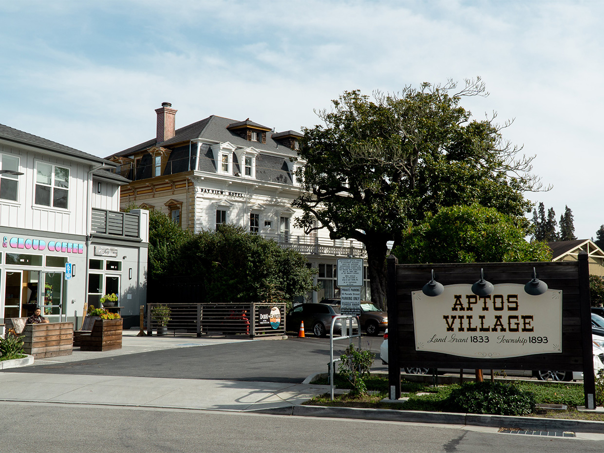
Somewhere along the way humans saw fit to keep the indigenous names of places. Soquel is the original people’s name meaning ‘rushing waters’ – Soquel Creek still rushes and that seems a fine name, still. The indigenous name “Aptos” could have meant people, which works still, or ‘meeting of two streams’ which is also true. It might be a good start to begin revitalizing the indigenous names of places.
Changing Back
Junipero Serra Peak is being changed back to Pimkolam a shortened version of “pimkoia’m, ti’at aula” the indigenous name for anunknown plant that grows there. Prior to 1950, it was known as Santa Lucia Peak. Near San Juan Bautista (a terrible name), an important site to local native peoples is now protected and is known by its original name, Juristac.
Other Changes
Without explanation, the current administration is making some seemingly sinister changes to place names. For instance, the highest peak in the USA is appropriately named by indigenous people ‘Denali’ but the President wants to change it to Mount McKinley. That same someone with power recently also decided to change the name of the Gulf of Mexico to the Gulf of America; I say let’s at least add an ‘s’ to that – the Gulf of the Americas would at least help us to realize that South and Central Americans are Americans, too. If it is becoming more acceptable to change place names, I say let’s go for it- there are lots of other changes and perhaps the next administration can force through a bunch in its first 100 days.
More Changes Needed
I have a particular problem with some place names imposed on locations and wish them changed. Far too many places have the name ‘devil’ in them. Devil’s Gate in Eastern California is one such instance. There are many more. Then there are legions of places named after people who barely deserved to have anywhere named for them. Scotts Valley, for instance: why do we care so much for Hiram Daniel Scott to have his name affixed to the town, still? And, does the town really deserve to be called a ‘valley’ anymore? Davenport, (for ‘Captain John Davenport’ the whaler) for that matter, deserves another name.
And then there are the religious references, so out of date. Santa Cruz makes little sense, anymore, if it ever did. And all those saints, San Lorenzo, San Luis, San Jose, San Francisco – so much potential for renaming there!
Let’s Ask The People
As we thankfully have momentum for recognizing the lands around us as unceded territory of various other peoples, wouldn’t it feel good to begin replacing the colonist imposed names of places with the names given those places by the people who lived there for thousands of years? If there are places without such names, why wouldn’t those representing the tribes play a central role in giving those places appropriate names? Let’s learn together the renaming that needs to take place – it will help bring us together and help more people respect and look anew at the land around us.
-this post originally published in the wonderful BrattonOnline blog featuring smart commentary and analysis by the Monterey Bay Area’s most insightful journalists.
Extraordinary heat is the news from Molino Creek Farm…and everywhere around the Central Coast of California. It has been in the 80s during the day for a few days running and going down into the 60s at night – enough to cool the house, thankfully. The sun beat down so wiltingly, burning right through the shirt. Panting finches, beats propped open. The biggest yellow-bellied racer I ever saw, living up to its fast name, slither-whipped across a trail. Snake weather! Clear blue sky days and most sparkling star depth nights. What interrupts the sky are occasional clouds of road dust and legions upon legions of zooplankton. Clouds of tiny metallic green Ceanothus beetles and many others, whirring and spinning above the shimmering hot fields, mopped up by swallows, pounced on by bluebirds.
Quince flowers are always the first to really create some art in the Orchard
Herbivory
The panicky quick growth of Spring is riddled with insect holes, shot through with orange rust fungus. Blue or yellow butterflies energetically flit from leaf to leaf, setting down eggs, flick over to a flower for a sip, and then more frenetic egg laying. Smooth green, fleshy caterpillars or ones covered thickly with prickly black hairs…munch leaves, everywhere, bodies swaying, mouths hungrily arching back into fresh foliage.
Walking with sandals through the hard-to-see overgrown trails makes for orange footwear, orange feet. Wild oat leaves, especially, but also our garlic crop, blackberry and many other plants have been besieged by rust fungi. Leaves turn orange, giving off dusty orange puffs of fungal spores; a closer look reveals thousands of odd evenly spaced orange dots. The fungi are feasting where the insects have failed to feed.
Orchard cover crop almost shoulder high
The Deer
The saga of ‘deer in the fence’ continues. We have two large fences. Maybe too large fences. Seems we can’t keep up with the fences. Do fences shrink or are the deer bounding better? Gradually, we add a few more feet on top of the old fence, which was only 4’ of ‘field fencing’ with another set of spaced wires to get the thing to perhaps 7 feet. The wire spacing technique burned up in the last fire, so the top wires hang willy nilly in many places and The Deer find their way over or through that weak link. Gradually, we discover the favored fence jumping spots and add new sections of fencing to close those gaps. Above Vandenberg Field, the (once) new fence extension ends and right where the old, shorter, less effective fence begins…is the Trail of Deer. A team of four (mighty healthy looking) deer come and go as they please through that weak point. This evening, all 4 deer were lined up at the Most Delicious Salad Bar, enjoying a Greek Feast of freshly sprouted grape leaves right at mouth height, held up on vineyard trellis.
California Poppy flowers are really going mad right now at Molino Creek Farm
Flowers!!!!!
The quick Spring creates a riot of flowers, all blooming at once. The woodlands surrounding the Farm are dense with post-fire California lilac, shiny leaves and hundreds of acres of blue, sweet bouquet. Where the shrubs don’t crowd, native understory flowers bloom: fat false Solomon’s seal and milk maids, redwood sorrel and native blackberry. Out around our fields, in the native prairie, there are rafts of California poppy and the beginnings of the first sky lupine, buttercup, and blue eyed grass. Native grasses are blossoming, too: purple needlegrass and brome, mainly.
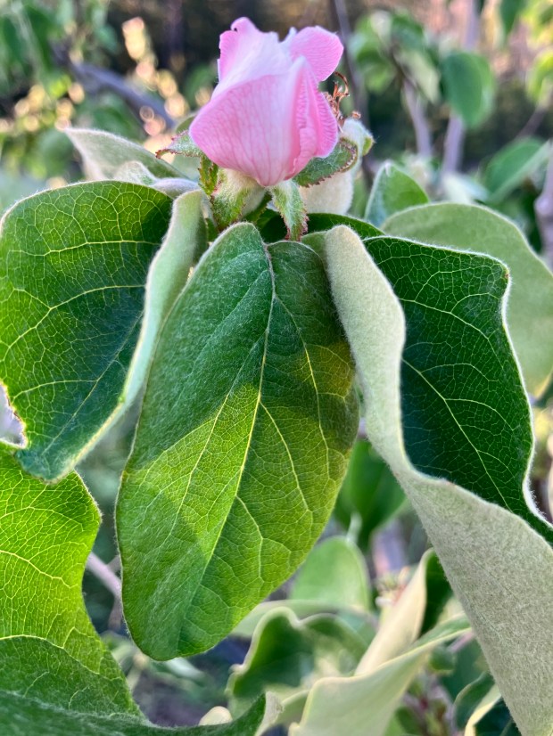
The orchards are blooming, too. The earliest pome fruits, quince, are in full joy as are the navel oranges and avocadoes. The scent of citrus wafts far from the orange trees across the farm, a sweet perfume. Cherry blossoms have just burst out in the last couple of days. It won’t be long before the entire apple orchard is pink….so early!
Cover crops bloom in masses. Row after row of bell beans are blossoming in the interstitial areas of the orchard; their fleshy thick leaves barely hiding whorls of big pea flowers. In the row crop fields, daikon radish is head high presenting blinding pure white sheets, abuzz with bees.
This is the way that Spring rushes towards, and soon past, our open-mouthed surprised selves: WOW! Time is moving quickly.
On February 5, 2026, the upper foot of soil surrounding the Monterey Bay was dry, a week later it was wet. For weeks, during the time of year when our Mediterranean climate should have been at its wettest, the rain had stopped and the sun’s radiance warmed as if it were summer. Shallow soiled areas of prairie turned drought-stressed reds and purples, grasses stopped gaining height and started blossoming. Redwoods and pines wafted clouds of yellow pollen, carried far in the rare warm breeze. Mushrooms and mosses withered and dried. Dust blew off of unimproved roads and farm fields. And then the rains returned.
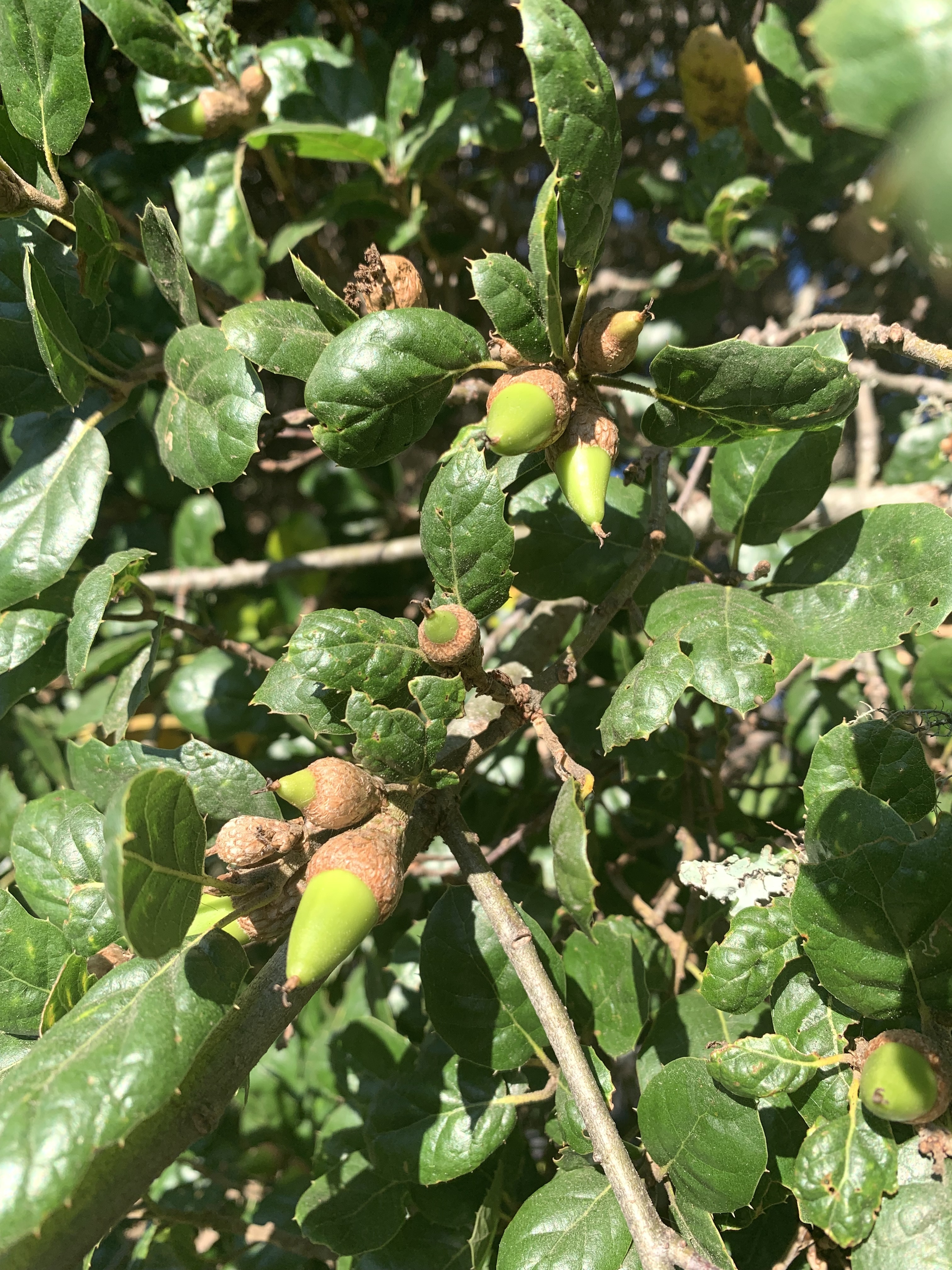
Coast live oak acorns – these trees rely on fungi for their nutrient and water uptake
Oscillating Unpredictability
Climate change models suggest that we should come to expect the unexpected, waves of hotter and hotter drought interspersed with deluge and destruction. Will being a Mediterranean climate area mean anything anymore in the future? (next time you vote, even in a local election, you are making a choice in this pro-mayhem or pro-life dichotomy) 2026 year marks the 3rd time since 1986 with such a dry hot period during the time of year when it should be the wettest and coolest. All have been recent. How does Life adapt? I wonder about the fungal webs that are crucial to the forests and shrublands around the Monterey Bay.
Mushrooms are just the ‘tip of the iceberg’ of sometimes extensive fungal mats running through the soil
Natural Fungal Flux
The rhythm of fungi is easy to see if only you look for chanterelles. This bright orange tasty mushroom pushes through leaf duff a while after the ground gets wet. Wetter years make for more mushrooms. Prolonged moisture and not-too-cold weather makes for the biggest crops. Eventually, they get tired and as spring progresses, they disappear until the following wet season. Other mushrooms have their time in this cycle, some preceding the rains by a bit with the shortening days…others bounce out at the first raindrops…and still others wait for the warmth and drying of summer. Peak mushroom diversity used to be typically in that middle zone, in January, when the landscape had long been very wet and the days quite short and cool.
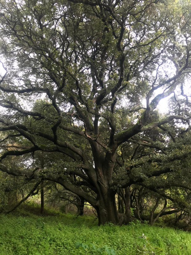
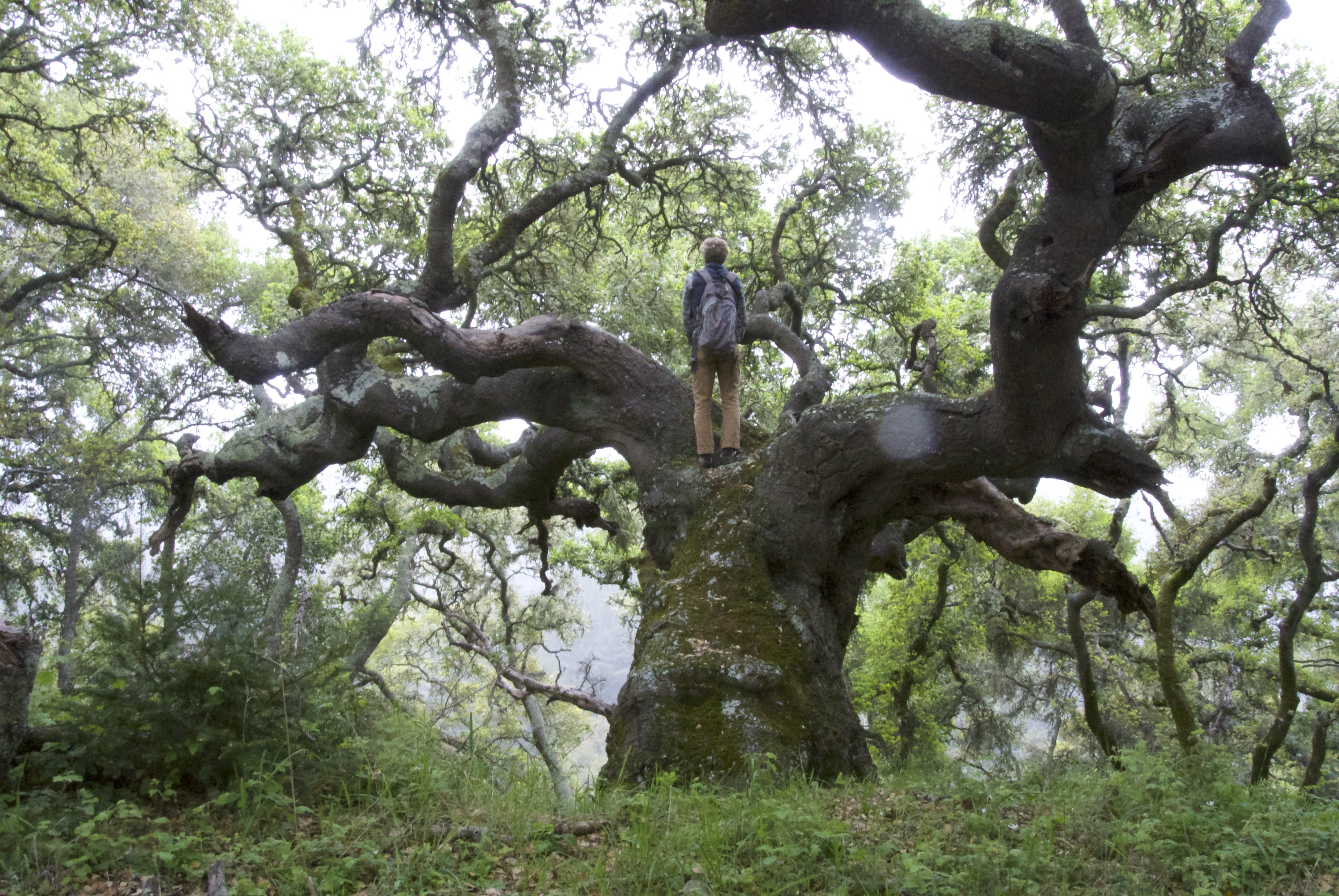
A large coast live oak
Dependency
The handful of oak species in our region along with the redwoods, pines, and firs require fungal communities to survive. So, too, do the manzanitas and madrones. In the orchards, almonds, apples, pears, hazelnuts, walnuts and so much more likewise depend on fungi to do their foraging. These trees have no root hairs to soak up nutrients and water; instead, they have evolved roots engineered to house fungi. Trees supply fungi sugars and fungal webs spread out through the ground, supplying trees nutrients and water. Dr. Tom Parker at San Francisco State University discovered 250 species of fungi under a single manzanita bush. We know very little about which fungi do what for who.
Under My Oak
I planted two coast live oaks in my yard, and one has been very evidently nurturing an interesting fungus. Dead Man’s Foot is a kind of puff bally thing that sticks a large, 6-inch or so, stumpy dark brown ugly ill-formed mass out of the leaf litter in the late spring. Some suggest a shallow burial with an emergent rotting foot, but it doesn’t smell unpleasant. As I mow grasses short each spring, this area doesn’t need much attention, except to rake up oak leaves. The grass barely grows and other weeds are missing – the place is nearly bare: the dead man’s foot is delivering every bit of nutrient to this fast-growing oak. Nearby, another oak planted at the same time doesn’t have these phenomena: it grows more slowly, is emersed in tall grass and weeds, and doesn’t have any fungi popping up in its understory (yet!).
What Happens
How will the climate change driven droughts and deluges affect fungi and the life that depends on them? There are a suite of fungi that follow wildfire, but will they withstand more frequent and more severe fires? Will the succession of winter fungi that are used to long, cool, moist winters survive winters that are less predictable? How will the forests and shrublands fare if their fungal foundations are shaken? How will we even know?
Frog song, forest tending, restoration reflections, and burn piles – just a few of the things happening at Molino Creek Farm this past week.
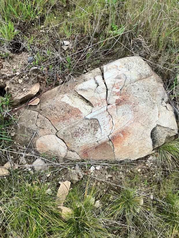
The geological substrate of the Farm: Santa Cruz Mudstone. (this one looks grumpy). This is on an old railroad grade bank- lower restoration site in an area planted with purple needle grass in 2010
Frog Song
The cement pond has lots of algae and lots of frogs, singing. This is the second season with a new regimen of pond management. In summer, we try to keep the pond swimmable with chlorine and such. As winter approaches, we stop with the chemicals and allow the pond to go feral. The algae starts growing and frogs quickly move in, and also the newts. The frogs are Pacific chorus frogs, which are relatively small but loud. They can change color in just a few hours to blend in better to their surroundings. For unknown reasons, they start singing louder and louder and then stop, then build up steam again and stop again…right through the night and sometimes in the day. Guests staying the Barn are quite close to the cacophony, which takes some getting used to if one wants to sleep. They are laying eggs which become thousands of tadpoles that gradually grow legs and hop away into the adjoining orchards where they help control pests. Well, I suppose no few of those tadpoles get eaten by newts, which also make eggs and newtlets in the pond.
Post 2020 fire redwoods- resprouting!
Forest Tending
We are still cleaning up after the 2020 wildfire, and that cleaning up is helping to prepare for the next one. Bob Brunie has been hard at work getting a patch of Douglas fir in order. That stand adjoins our entrance road and presented quite a hazard during the recent wildfire: it was burning so intensely as to thwart any attempt to use the road, so it was briefly impossible to quickly respond to threats to uphill structures, which may have resulted in some wildfire damage. The fire left lots of dead trees and parts of trees – fuel for future wildfire and a repeat of the last one in blocking the road. So, Bob’s been chopping down dead trees, trimming up branches, and hauling out understory fuels to be burned in piles. We were concerned about Douglas fir invasion before the last fire, but now stands have become quite rare, so this project has become a kind of important forest restoration project. Plus, a shady grove is welcome on hot summer days and some wildlife species probably are glad for it.
Meanwhile, I spent a bit of time cleaning up burned willows and fallen conifers on another patch of farm ground- alongside our ephemeral stream where one day there might be some good camping spots.
Let’s reflect a little deeper on some other longer-term restoration work the Farm has been up to…
Bracken fern is plentiful in the upper restoration site
Scrub Transformation
Molino Creek Farm landmates and a network of generous community members have been working with nature to steward this land since 1982 and recently have been embarking on coastal prairie restoration. Photos from the 1980’s show much of this land as meadows. The legacy of indigenous land tending presented lush prairies to the first colonists who took advantage of the abundant forage to feed livestock. Barbara McCrary reported that her husband Lud’s grandfather’s journals noted landscape-level neighborliness with gatherings on this parcel to tend the hay crop in the late 1800’s. Only recently, because of changed stewardship, have the meadows been transforming into scrubland, but two wildfires helped reverse that and we’ve been taking advantage of those to nudge the ecosystem back to the very-endangered coastal prairie ecosystem.
Small flowered needle grass in the upper restoration site: rare situation- most of the area doesn’t have native grassland species, yet.
Recent Prairie History
Two wildfires, a prescribed fire, and large-scale mowing have been tilting two large sections of south-facing slopes towards the grassland direction. In 2009, the Lockheed Fire engulfed 270 degrees of the Farm and firefighters set back burns to one of what is becoming a south-facing restoration site. Firefighters fanned across the slope and, just in time, set the scrubland above Vandenberg Field on fire, pulling advancing wildfire away from one of our homes. The slope subsequently erupted in thistles and then reverted to scrubland by the time the 2020 CZU Lightning Complex Fire once again burned it. With it went an area downhill in what has become the second restoration site (below Vandenberg Field). In 2024, the Central Coast Prescribed Burn Association burned that second site. After each of those burns on the second site, Moliñeros scattered locally collected grass and wildflower seeds, including across an acre that had been planted in 2010 in native grasses and coastal scrub species. Matthew Todd helped us last year to mow the uphill site, which had burned in 2009 and 2020 but was around 5 feet tall in poison oak, coyotebrush, and French broom.
The lower restoration site, which we have seeded, has lupines and poppies- here just beginning to flower
Restoration Now
Interestingly, the two restoration sites are evolving quite differently. For both sites, ecological reactions to the first fires were similar: very poor-looking soil, lots of bare ground, then broadleaf weeds (thistles), and then resprouting coastal scrub species. After 2 quick-succession fires and seeding, the lower site is transforming into very lush grassland. After 2 widely spaced fires and then mowing last year, the upper site has only rare patches of grassland and lots of broadleaf weeds/resprouting coastal scrub species. If the lessons from the lower site apply, that upper site needs another fire, and/or mowing…soon – and seeding!
It is most curious that the soil seems so poor during early stages of restoration and then gradually produces more and more lush grassland. Is it because so much of the nutrients are caught up in scrub biomass, and that has to decompose and become available for the grassland…or, is there some soil biome shifts occurring? Maybe one day we’ll know!
Burn Piles
A key component of this land tending is biomass disposal. If we don’t do it, Nature will! We were pleased that the 2020 CZU Fire burned up many brush piles, but we might have placed them better and surely lots of critters, thinking they were safe below all that biomass, were cooked alive. To avoid burning up critters, we move piled up brush to an adjoining spot to burn. Wherever brush is piled and rests for more than a few days, there are lizards, snakes, rodents, and sometimes even foxes hiding in the mess.
This land creates an amazing abundance of biomass, which presents a threat when wildfire comes. This productivity is evident in our row and orchard crops and equally easy to see in the growth of scrub, grassland, and forest. The post-fire cleanup has generated a lot more biomass to be moved around (MOOP!), mostly burned but maybe we’ll figure out gully stuffing and chipping at some point. We should probably aim for 70 burn piles a year to keep making progress; we are at 15ish now with more stuff piling up by the day and we have until April to burn it up (or wait until next December). Bonfire Fun!
Putting the City of Santa Cruz in perspective, an aerial view from a flight on 2/2/2026
What if there was a Community Town Hall in the City of Santa Cruz? Might such an endeavor help Santa Cruzans learn to support politicians more representative of their better-informed viewpoints? Could we add to the growing national movement to overcome entrenched, well-funded, and prejudiced political organizations? Is it possible that a Community Town Hall could help steward civic engagement to better inform decision making on critical issues?
Outcomes
If such an institution could be formed, how would we measure its value? In the long term, we would want this potentially expensive endeavor to be politically relevant. In the shorter term, participants would need to see it as a good use of their time. We would want the populace to agree that it well represented them in every respect. And, we would want to see increasingly more people being civically engaged, including more voter registration and turnout during elections.
Background
The term “town hall” is well used and has deep roots in US society. Elected officials have used town halls in various ways. Cynically, they are seen as ways of “representatives” seemingly listening to their constituents. But, how frequently do elected officials change anything from such feedback? Especially recently, such meetings have been disrupted by angry people and activists. The internet suggests that town halls are ways that company leadership hears from their employees. Buried deep in the internet searches, you find the term ‘community town hall,’ and even a bit of guidance on running such things.
Generally speaking, community town halls have rules and facilitation that allows respectful civic dialogue, sometimes between the community and their elected officials or other decision makers. I am not aware of any current, regular or even periodic convening of a town hall near Santa Cruz. For years, there was the Penny University but covid and the death of Paul Lee seem to have brought that to a halt. In the deeper past, I have taken part in faux town halls about the future of Cotoni Coast Dairies on two occasions run by two different organizations with no apparent outcomes. Besides those, there have been numerous ‘public input’ meetings but those are completely different.
Methodology
I would like to hear from others, but have a few ideas to share about how I see a Santa Cruz Town Hall being organized. The first imperative would be to form a representative body, engaging social scientists to help design that process. Participants probably ought to have ‘alternates’ to step in when they are unable to participate. Then there is the question of issue-formation: how will the focus of the Town Hall be informed? It seems like issues to be contemplated ought to be relevant and timely. One thing people seem to agree on about town hall methodology is that meetings need professional facilitation. It seems also important that the town hall’s deliberations have some level of buy in from decision makers, but these folk need not be key members of the town hall. Town hall leadership, though, is necessary. Perhaps a leadership committee could be formed. The facilitators and leaders would need to work together to formulate the deliberative processes and rules for the town hall.
Science, Fact, and Expert-based?
It seems important that sound deliberative processes should be science-based, but is that okay? The deliberative processes that I have seen work center on exploring the common curiosity of participants by collaboratively seeking out the best available information. Adults learn best when they feel the information they are hearing is provided by legitimate sources sharing salient information. However, some factions of today’s society have been suggesting that there are flaws in our information gathering system. If that is an issue in our community, we need to learn how to accommodate those concerns.
The Voice And Greater Engagement
How will a town hall have a voice and how will its work translate to the larger community? The role of journalism is one key issue that needs to be resolved. And, there will need to be deliberation of guidance about how to communicate the ideas that emerge from town hall processes.
However it is designed, the town hall needs to have a community engagement strategy. Somehow, a reciprocal flow of information between the town hall and the larger community seems important.
Suggestions? Want to Help?
If the City of Santa Cruz is to have a Town Hall, we need more ideas, commitment, and funding. If you want to contribute those, please let me know. We certainly need suggestions about how to best design this thing. And we need folks who are willing to help lead, facilitate, and convene the group. At first, a team will help as we work out a strategy and gather funding. After the strategy and funding are built, implementation may require more or different people. I’m hoping this idea resonates. Let’s see where it goes.
-this post originally published as part of the amazingly informative BrattonOnline blog – check it out and stay in touch!
Rain runs off of bark, soaks into soil, and hisses as it soaks rapidly into mudstone pores. Drops percolate through the earth, moistening roots and wetting bugs, coalescing into aquifers, seeping out in springs, flowing down as streams. Rainwater mixes with rain whipped ocean salt droplets but remains rather pure. As downpours, showers, or drizzle, rainwater washes nutrients out of the soil past slurping, hungry roots, bathing micro-organisms in nourishing soup. More pristine, richer soils more effectively capture free nutrients. More disturbed/tilled poorer ground loses nutrients. Nitrogen in particular leaches from disturbed soils and finds its way into groundwater or rivers, sometimes in such quantities as to be classified as pollutants.
Rain water collects in tractor rut in our perched-high Vandenberg Field, farmed by Two Dog Farm
Watershed
The Molino Creek watershed begins in vast swaths of maritime chaparral growing in fractured mudstone with very little discernable soil. Manzanitas, ceanothus, bush poppy, and such are the dominant chaparral shrubs, growing symbiotically with fungi. When the winter storms drench this chaparral, rocks soak up the first good bit before water soaks into the millions of cracks through this highly fractured rock. Down it soaks, a few feet for every inch of rainfall. There’s not much in that water, the nutrient poor ground rife with fungal threads gives up little to the flow. Under the mudstone is a dense sandstone. The interface is a line of springs. The seeping water converges, forming Molino Creek.
Tributary
There’s a tributary on our farm and it remains unnamed. Most know this stream for its 25-foot waterfall, which splashes noisily through the winter. There’s a productive spring in this stream and below it the stream flows year-round, although just a trickle in the drier summers. When the waterfall really roars, we know that the karst below us is full and to expect the lowest sinkhole to become a lake shortly. Water piles out of foot-diameter holes, pillows of powerful flow billow up into the rising lake.
One of the handful of holes connecting to karst from whence issues water during high rainfall events
Looking down the karstic hole…how far does it go?
Sink Holes
There are 5 larger sink holes on Molino Creek Farm and there are more on adjoining open space lands. The largest pock of collapsed limestone is 50 feet deep just off a trail downhill a bit on Cotoni Coast Dairies parkland. We also haven’t named the lowest, largest sinkhole but we see it most years, sometimes even with a flock of ducks. There is no known limestone on the other side of Molino Creek for a hundred miles north along the coast, but the limestone continues south to Santa Cruz and then appears again in Big Sur. Our farm’s sinkholes have nice deep soil to allow tomatoes lots of foraging space for nutrients and water. Somewhere way down below there are caves – tiny honeycomb caves or grand ballrooms decorated with flowstone and stalactites. Sometimes, they collapse, creating a dent in the ground above.
Rain-kissed Persian limes hang thickly awaiting harvest
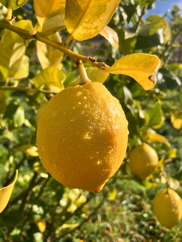
Citrus
Citrus Hill grows and produces – more each year. We planted many orange, lemon, lime, and mandarin trees in 2019 (-ish), and those are starting to produce. These trees are 4 – 8 feet tall, they are deep green and laden with fruit. We have harvested and distributed over 150 pounds of Persian limes with another 70 that are ready ‘to go’ (right now). Browsing harvesters are snacking on the first ripening mandarins. Four hundred pounds of oranges will gradually ripen between now and 3 more months. Meyer lemons are also slowly ripening.
Ditch meets road drain rolling dip on the main road into Molino Creek Farm
Roads
Our farm is 3.5 miles from the highway and we maintain another 3+ miles of roads on the farm. This land use changes Nature, requires work, and has many great advantages. The most evident road effect is hydrological: roads become waterways, sluicing rain and runoff into ditches and drains, carrying mud and road gravel. Human and non-human animals use the road routes – easier than the alternative. Long ago, the road from the highway was so poor that it required four-wheel drive and chains. Before that, it was on the back of horses or mules, ox carts, etc. and up a now-obliterated road parallel with Molino Creek.
Shovel and tractor, sweat and sore muscles, are called upon to keep the road drains clear, to spread new material, to fill holes.
Newts and Frogs
With the soaking drizzle, raining right through the night, amphibians are on the move. Driving home up the Coast Highway at 9pm, red-legged frogs were making brave attempts to cross the road in the pouring rain. Rough skinned newts were flashing their tummies, heads held high, trying to be seen. It was slow going slalom to avoid the critters. The small chorus frogs are singing loudly all night long in the cement pond next to the barn where they are laying eggs and cavorting. As a friend pointed out…when it is raining, the whole world is amphibian habitat!
A friend recently pointed out how one aspect of human behavior can provide hints about other parts of our personalities. For instance, with people who enjoy spicy foods: might it be interesting to see how they integrate endorphin rushes into other parts of their lives. Might they act in ways that invites pain, in other ways?
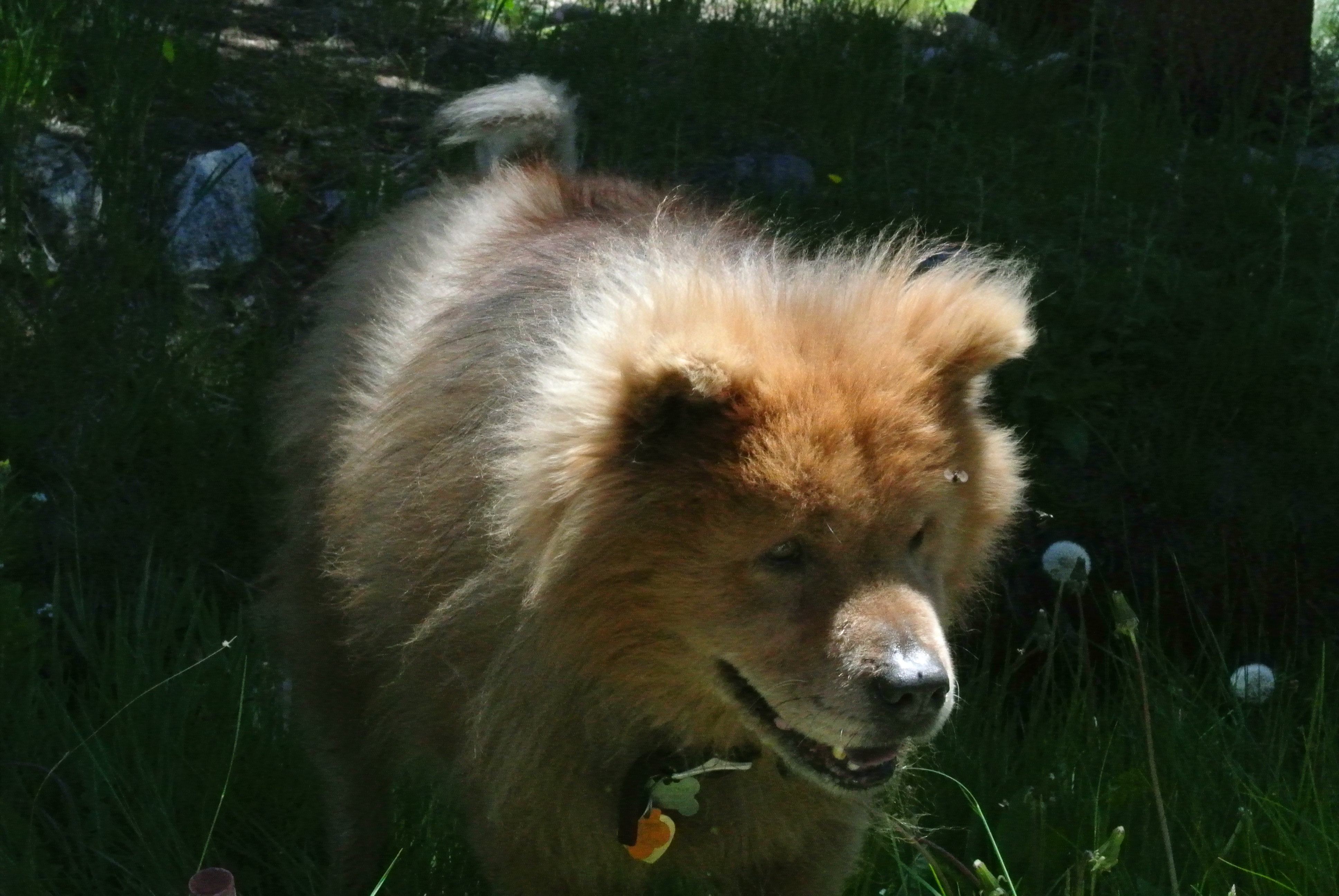
Similarly seeking analogs, I wonder if how people treat their pet dogs says something about their world view, in general?
What kind of person could treat this dog poorly? He was a good pet.
Fido, Get Over HERE!
Get their attention first by yelling their name, then give them stern ‘BAD DOG’ words. Yell it again if necessary, and again. If they finally show up, then smack them.
This habit of barking orders at dogs over and over, every time that the person feels the need to control their dog makes me wonder how that person sees the world. Physical brutality on top of that, just when a dog has (finally) acted as directed, makes me very sad for those relationships. Does command and control and physical brutality make sense in the larger world to such people?
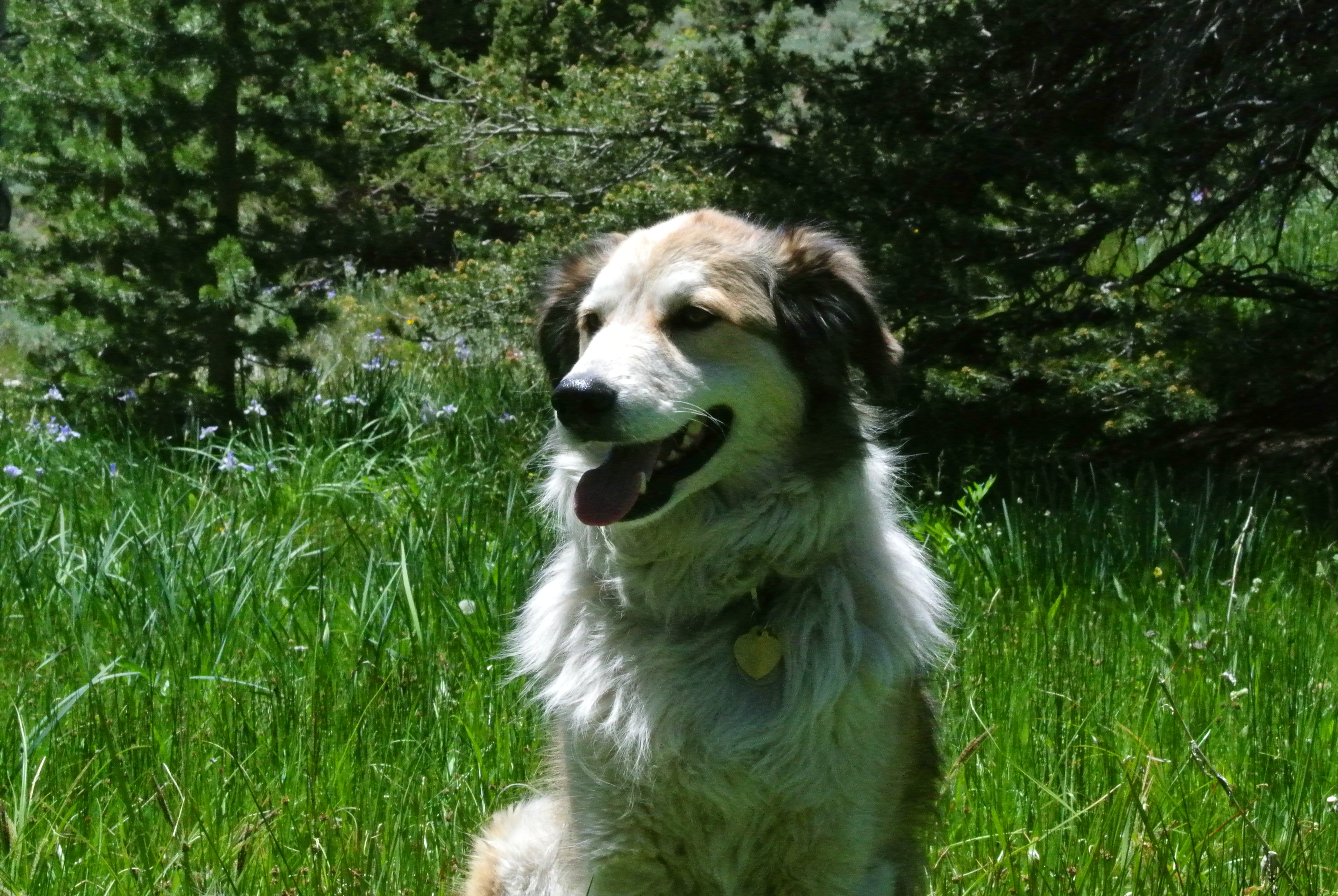
A Whistle Does It
On the other hand, I’ve seen people who have the most cooperative and loving relationships with their dogs. For instance, a certain whistle brings the dog running, tail wagging. Invariably when asked about how these people got to that point with their pet dogs, they say it took a lot of time and effort. Honing communication combined with positive reinforcement are key. Are people who arrive at such non-violent relationship building with pet dogs also apt to have a similarly well-evolved means of relating to their fellow humans?
Different dog breeds have different temperaments, to be sure, but communication is key.
What To Do?
I routinely run into this issue and it really bothers me. The Capitola DMV has it. The Davenport US Post Office has it. I bet you’ve seen it, too: signs that say something to the effect of ‘No Animals Allowed Inside.’ What are humans if not animals? Minerals?
This problem of mine also crops up regularly in social commentary and literature when some ‘smart’ person decides to add their (sometimes ‘witty’) comments about what separates humans from non-human animals. Such arguments are generally flawed and baseless.
Social Animals
How might the world be better if we learned from the science of how social animals have worked out social problems? What if our conversations turned that direction regularly? And, what if humans thought a lot about that when adopting social animals into our lives?
Learning from Nature
There is a wealth of wisdom that Nature can share. Humans have benefited greatly from many of those lessons, and additional learning can take us much further.
When we see ourselves in the dogs we are trying to acculturate into our lives, we learn both how to better mesh with the dog and better hold ourselves in human society.
We might also apply this kind of learning with other social animals in our lives: parrots/parakeets/etc, deer, crows, cows, goats, quail, etc.
The finest people have the finest pets. Do dogs really look like their owners?
Cautions and Next Steps
We taught to be cautious about ‘anthropomorphizing’ non-human animal traits. The caution goes that doing so might make you blind to important differences. How about some balance here, and the adoption of a new word? How about cautioning about ‘anthroscism’ – advancing the idea that humans are somehow wildly different than all the rest of the animals? Same kind of reasoning holds: doing so might make you blind to important similarities.
Your homework: start a conversation this week about some human reaction you see that reminds you of how non-human animals act and why that might be.
-this post originally appeared as part of the online weekly blog BrattonOnline.com – a compendium of important information from around the Monterey Bay and beyond. There are movie and TV review, historic photographs from Santa Cruz, links to great media, and columns from amazingly well informed authors. Check it out! Subscribe!! donate!!!! The Blog Needs Your Support.
Here it is…suddenly the season where we reflect on what it means to be thankful and what to be thankful about. All around us, beings are ecstatically grateful every moment. But, us humans seem to segregate our thankful moments, relegating them to holidays or ceremonies. Well, we should be happy for the ability to reflect in such a way, however it occurs.
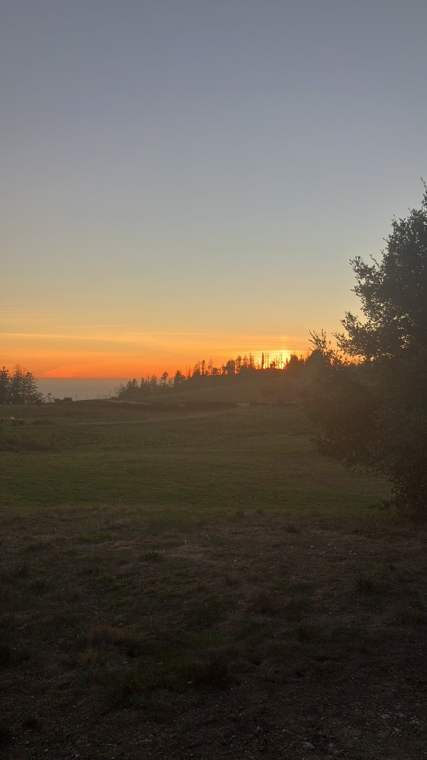
A recent sunset from Molino Creek Farm
Deep Time Thanks
Molino Creek Farm lies within the unceded territory of the Awasawas, or Santa Cruz People, in the Cotoni tribe. They lived on and cared for our land. They left lots of artifacts. There are places where seashells are still coming out of the soil. There are lots and lots of chert and some obsidian flakes. We have found bowls, mortars, and cooking stones. They were the first human inhabitants of this land and they took care of the old growth redwoods and ancient oaks that we still enjoy. Their land management made our soil rich for the crops we still grow.
The Greek Ranch and Transition
Much more recently, us Molino Creek Farm folks have The Greek Ranch and then Kay Thornley, Harlow Dougherty, Jim Pepper, Steve Gliessman, and others to thank for being here. There were years of hippies living here, wild years as we understand back in the Greek Ranch days. As the Greek Ranch transitioned to Molino Creek Farm, this contingent from UC Santa Cruz managed to purchase the land and created the organization that we have now. Many thanks to the folks who had the patience and fortitude to wade through all sorts of issues in establishing this cooperative.
A few Lisbon lemons still left on the trees
Farming
Joe Curry, Judy Low, Mark and Nibby Bartle, and many others worked very hard to establish Molino Creek Farm, which became a legend for dry farmed tomato production. The early farmers made enough money and worked hard with piles of purchased materials to put up miles of deer fence, long stretches of irrigation, and a very good agricultural well. They bought equipment – tractors, fuel tanks, implements, generators…much of which we still rely on. These intrepid farmers taught many people how to grow dry farmed tomatoes and those people started their own businesses. The Farm was the 13th certified organic farm in California…there are hundreds now. We must thank these organic farming pioneers for showing how it’s done and inspiring others to give it a go.
Intentional Community
Other work deserving thanks is from the communal spirit and willingness of those who co-own this land. Living together in such a rural place takes work. The Farm is off grid and so produces its own power and water. We live 3.5 miles up a private road, which takes a lot of maintenance. They say people used to have to drive with chains to get up a muddy hill on the way in, and even then it wasn’t certain.
We have people who manage the finances, ‘the books,’ taxes, meeting facilitation, meeting notes, work party conveners, and so much more. Some of the group maintain the farmland, others maintain the wildlands, and others the water infrastructure. There is a legal committee, a road committee, and a neighbor committee – all very necessary. It takes great generosity to make these things work and we remain grateful to one another for the things we fit into our otherwise busy lives to help keep things together.
2020 Fire
The CZU Lightning Complex Fire devastated our farm. We lost two homes and a community garage workspace, fences, parts of our water system, many orchard trees, and much more. We put out word about what happened and an accompanying call for assistance. Within a short while, we raised $80,000 to help generally and a big portion of that to revitalize what was lost in the orchard. Such Huge Generosity!! We are still awed by that support. The financial support we received is just one indication of the strength and support of the social networks that the partners in this endeavor hold and tend.
We lost quite a few of our avocados in the 2020 fire, but they are just starting to fruit again
Land Stewardship
Since the fire, we have had amazing support for tending our land. The Prescribed Burn Association has poured support into teaching our cooperative about good fire and then leading a prescribed burn last year, reducing fuels over many acres, restoring coastal prairie. They brought people here to help and keep in touch, watching with us the effects of their management. Now CalFire is offering that same kind of help!
Neighbors
Our neighbors have always been helpful. For years, the folks at the cement plant helped keep our road in good shape, the gate secure, and even supplied us with road material, rocks, and spare cement. PG&E has chipped in lots of funding and work to keep the road repaired.
The partners with the San Vicente Redwoods have also been unendingly great to us. Roadwork and weed work, fire and fuel management, security, and so much more have all been graciously a part of their contributions. We are learning together how to take better care of our lands, the non-human beings, and each other.
Community Orchardists
For 15 years, we have enjoyed the growth of our Community Orchard. We keep in touch with 225 people on email. 5 – 20 people show up to tend the orchard on many Saturday afternoons. Even though the fire took us backward a step, 5 years later we discover the orchard has surpassed that damage and is creating more and more amazing fruit, feeding more people.
This year, we needed a tractor and the community orchard network donated funds that allowed us to buy one this past week. It is amazing how the generosity continues, born out of the relationships we build by tending a beautiful orchard, creating “Fruit for the People!”
In sum, we are very thankful. We have so much to be grateful for. Thank you, each and every one of you, for the various kinds of love and support you offer this amazing place, this greater community, which we steward together.